
 40.835° N, 9.686° E


Complete guide
Cala Brandinchi: beach guide
What the beach is like
Cala Brandinchi is a beach in the municipality of San Teodoro, in north-eastern Sardinia. According to the tourism portal of the Sardinia Region, it lies in the locality of Capo Coda Cavallo and is one of the best-known beaches in Gallura. The same portal reports that it is called "little Tahiti" and that specialist websites have placed it among the 15 most beautiful beaches in Sardinia.
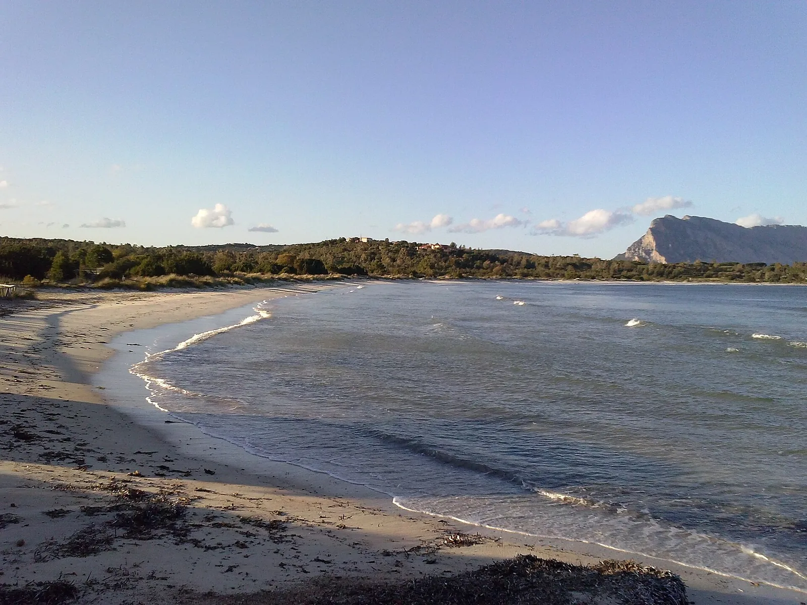
The beach is a long, narrow strip of white, fine and compact sand. Around it are sand dunes covered with junipers, rushes, sea daffodils and aromatic plants. Behind Cala Brandinchi are well-kept gardens and a pine wood, with shade, a refreshment point and a large car park that is also suitable for campervans.
Behind the beaches and the pine wood lies the Brandinchi lagoon (stagno), home to herons, black-winged stilts and pink flamingos and a good place for birdwatching. The Brandinchi lagoon is a wetland close to the north-eastern coast of Sardinia, in the municipality of San Teodoro, and its original Sardinian place name is Cadranzolu.
A jetty takes small pleasure boats. It was from the port of Brandinchi that on 17 October 1867 Giuseppe Garibaldi, after escaping from Caprera, set sail for Piombino in an attempt to free Rome.
Getting there
To reach Cala Brandinchi, start from San Teodoro and drive about seven kilometres along the statale 125, turning off at the locality of Lutturai towards Capo Coda Cavallo and finally taking a dirt road. On the length of the dirt road the regional tourism portal's page gives two figures: one and a half kilometres in the description and about 1 kilometre in the driving directions. The village of San Teodoro lies 7.2 km as the crow flies south of the beach, Olbia 18.3 km to the north-west.
From the Cala Brandinchi car park you can also reach the twin beach of Lu Impostu, linked to Cala Brandinchi by a path through the Mediterranean scrub. The two beaches are separated by a small headland. Before setting off, it is worth checking with the municipality whether any access rules for the beach are in force.
When to go
According to QualeSpiaggia data, the beach faces south-east and looks out onto the Tyrrhenian Sea. With the east wind (levante), the sirocco (scirocco) and the south wind (ostro), the wind blows from the sea and the beach is exposed to the waves. With the tramontane (tramontana), the west wind (ponente) and the mistral (maestrale), the wind blows from the land and the sea near the shore tends to be calmer. The gregale (grecale) and the libeccio (libeccio) hit it from the side. This is an indication based on the orientation of the coast, not a forecast.
Seabed and sea
The seabed at Cala Brandinchi stays very shallow for tens of metres, with a swimming-pool effect. The white of the sand brings out the shades of the water, from emerald green to turquoise and from light blue to cobalt blue. Where rocks break the surface the water has dark reflections: the rocks are the habitat of rich marine life and a point of interest for snorkelling. In the 2025 season the water at Cala Brandinchi was rated excellent by the European Environment Agency (EEA).
In the marine protected area, diving centres take visitors to various dive sites.
Facilities and free beach
The regional portal describes the cove as having all facilities: rental of beach equipment, pedal boats, canoes and inflatable boats for excursions. On the beach there are also bars and areas for sports. The pine wood behind the beach provides shade.
Rules and protected areas
The coastal spots of the municipality of San Teodoro are part of the marine protected area, which covers 15 thousand hectares from Capo Ceraso to Punta s'Isuledda, its southern boundary. The protected area also includes the islands of Tavolara and Molara and the islet of Proratora. Anyone sailing in the area should check the rules of the protected area beforehand.
With children
For the regional portal, the shallow seabed with its swimming-pool effect makes the beach suitable for children to bathe and play. Even so, it is best to keep a constant eye on them in the water and protect them from the sun.
Nearby
Lu Impostu beach lies 1.2 km as the crow flies to the south and is shorter than Cala Brandinchi but wider, with equally white and soft sand and dunes dotted with junipers and mimosas. Its southern boundary is Puntaldìa, a tongue of sand that marks the northern end of La Cinta.
Salina Bamba is 1 km as the crow flies to the east and has the Salina Manna lagoon behind it. Also to the east are the spiaggia delle Farfalle, also called Cala Suaraccia, at 1.8 km, and Salinedda, at 1.7 km. The view from Baia Salinedda takes in the island of Ruia.
La Cinta is 4.5 km as the crow flies to the south. In 2026 the FEE Blue Flag list includes, for the municipality of San Teodoro, La Cinta beach. On the length of La Cinta the two pages of the regional portal disagree: one gives five kilometres, the other three. Behind it is the San Teodoro lagoon, a stopover for pink flamingos and home to the black-winged stilt.
Sources
- Wikipedia (it) — Stagno di Cala Brandinchi
- FEE Italia — Bandiera Blu 2026, elenco spiagge
- OpenStreetMap
- EEA — Bathing water quality 2025 (IT020104023016)
- QualeSpiaggia — open data spiagge (CC BY 4.0)
- Cala Brandinchi | SardegnaTurismo - Sito ufficiale del turismo della Regione Sardegna
- Capo Coda Cavallo | SardegnaTurismo - Sito ufficiale del turismo della Regione Sardegna