
 40.690° N, 8.200° E


Complete guide
Porto Ferro: beach guide
What the beach is like
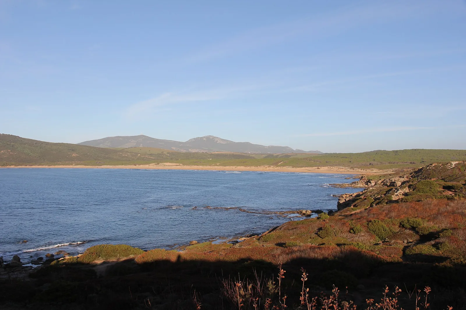
Porto Ferro is a bay with a beach on the north-western coast of Sardinia, facing the Sea of Sardinia (mar di Sardegna) between Argentiera and Capo Caccia. It lies in the Nurra, within the municipality of Sassari. In Sardinian it is called Portu Férru and in Sassarese Porthu Férru.
It is a deep inlet, at the end of which lies a beach two kilometres long. The sand is yellowish-red, and the bay takes its name from this colour. The grains are fine, of a dark amber colour, reddish in places and golden in others, mixed with shells. The bay is enclosed by rocks and red trachyte hills dotted with Mediterranean scrub. Behind it are a pine wood and sand dunes covered with sea daffodils, which separate the beach from the lago di Baratz.
Three seventeenth-century Spanish watchtowers overlook the bay, built against the threat of Saracen raids. They are the torre di Bantine Sale, also called Torre Mozza, the torre Negra and the torre Bianca, also known as the tower of Airadu. The medieval village of Barace, whose inhabitants traded in salt, once stood in the area.
Getting there
You get to Porto Ferro along the 55 bis road, turning off at the sign for Porto Ferro. It can also be reached from provincial road 69. As the crow flies, Alghero is 17.5 km to the south-east and Sassari 30.7 km to the east. The nearest villages are Palmadula, 6.6 km to the north as the crow flies, and Santa Maria La Palma, 6.8 km to the south-east.
When to go
The beach faces south-west. With the southerly (ostro), the south-westerly (libeccio) and the westerly (ponente), the wind blows from the sea and the beach is exposed to waves. With the tramontana, the north-easterly (grecale) and the easterly (levante), the wind blows from land and the sea close to shore is calmer, with the bay sheltered. The scirocco and the mistral (maestrale) hit it from the side. This is an indication based on the orientation of the coast, not a forecast.
The bay is popular for surfing and windsurfing, thanks to the frequent strong winds and high waves. The regional tourism portal describes it as a beach that is never crowded. On windy days it is wise to assess sea conditions carefully before going into the water.
Seabed and sea
The seabed slopes gently from the shore. A few rocks break the surface here and there in the inlet, and the water ranges from emerald green to blue. For this beach, QualeSpiaggia has no EEA water quality classification.
Facilities and free beach
The beach has car parks and refreshment points. In 2026, Porto Ferro appears, together with Porto Palmas and Platamona Rotonda, on the FEE Blue Flag list for the municipality of Sassari. The Touring Club chose it among the most beautiful beaches in Sardinia.
Rules and protected areas
A section of the beach has been officially authorised for naturism, under the regional tourism law of 28 July 2017. Naturists use the northern part, near the torre Bianca. The travel website Skyscanner ranked it fifth among the most beautiful nudist beaches in Europe.
The area that includes the lago di Baratz, Porto Ferro and the dune system is recognised as a site of community importance. It is part of the Sardinian geo-mining park (parco geominerario della Sardegna) and borders the Porto Conte regional park. The bay marks the northern limit of the Riviera del Corallo.
Nearby
The lago di Baratz is the only natural lake in Sardinia. Dunes up to thirty metres high separate it from the beach. Its waters are oligohaline, almost fresh, and the lake has no outflow. Around it you can see purple herons, marsh harriers, coots, mallards and kingfishers.
The wood is crossed by waymarked paths. One starts from the torre di Bantine Sale and follows the coast past several coves to the Le Prigionette forest, another leads from the beach to the lake, and a third loops around the lake.
The lake formed when a massive bar of sand, carried by storm surges and wind, dammed river valleys that had once been flooded by the sea. Around it grows a pine wood dating from the mid-twentieth century, alternating with strawberry trees, junipers, mastic trees, heather, lavender, myrtle and rosemary. Staff from the Ceas, the centre for environmental and sustainability education, guide visitors through its ecosystems. During the Second World War the lake hosted a German base, and when the order to retreat came, ammunition and mines were thrown into its waters. When the water level dropped at the end of the twentieth century and some bombs resurfaced, a clean-up followed. According to the best-known legend, the ancient city of Barax sank into the lake.
Porto Palmas, also on the 2026 Blue Flag list, lies 7.5 km to the north-west as the crow flies. Porto Palmas, in the municipality of Sassari, has dark golden sand. Cala dell'Argentiera, 7.2 km to the north-west as the crow flies, is surrounded by the buildings of a lead, silver and zinc mine that remained active until 1962. The Mugoni beach, 8 km to the south as the crow flies, lies in the bay of Porto Conte, inside the Capo Caccia marine area. The Mugoni beach is a two-kilometre stretch of pale, soft sand.
Sources
- Wikipedia (it) — Porto Ferro
- Wikivoyage (it) — Sassari
- FEE Italia — Bandiera Blu 2026, elenco spiagge
- OpenStreetMap
- QualeSpiaggia — open data spiagge (CC BY 4.0)
- Porto Ferro | SardegnaTurismo - Sito ufficiale del turismo della Regione Sardegna
- Lago di Baratz | SardegnaTurismo - Sito ufficiale del turismo della Regione Sardegna