
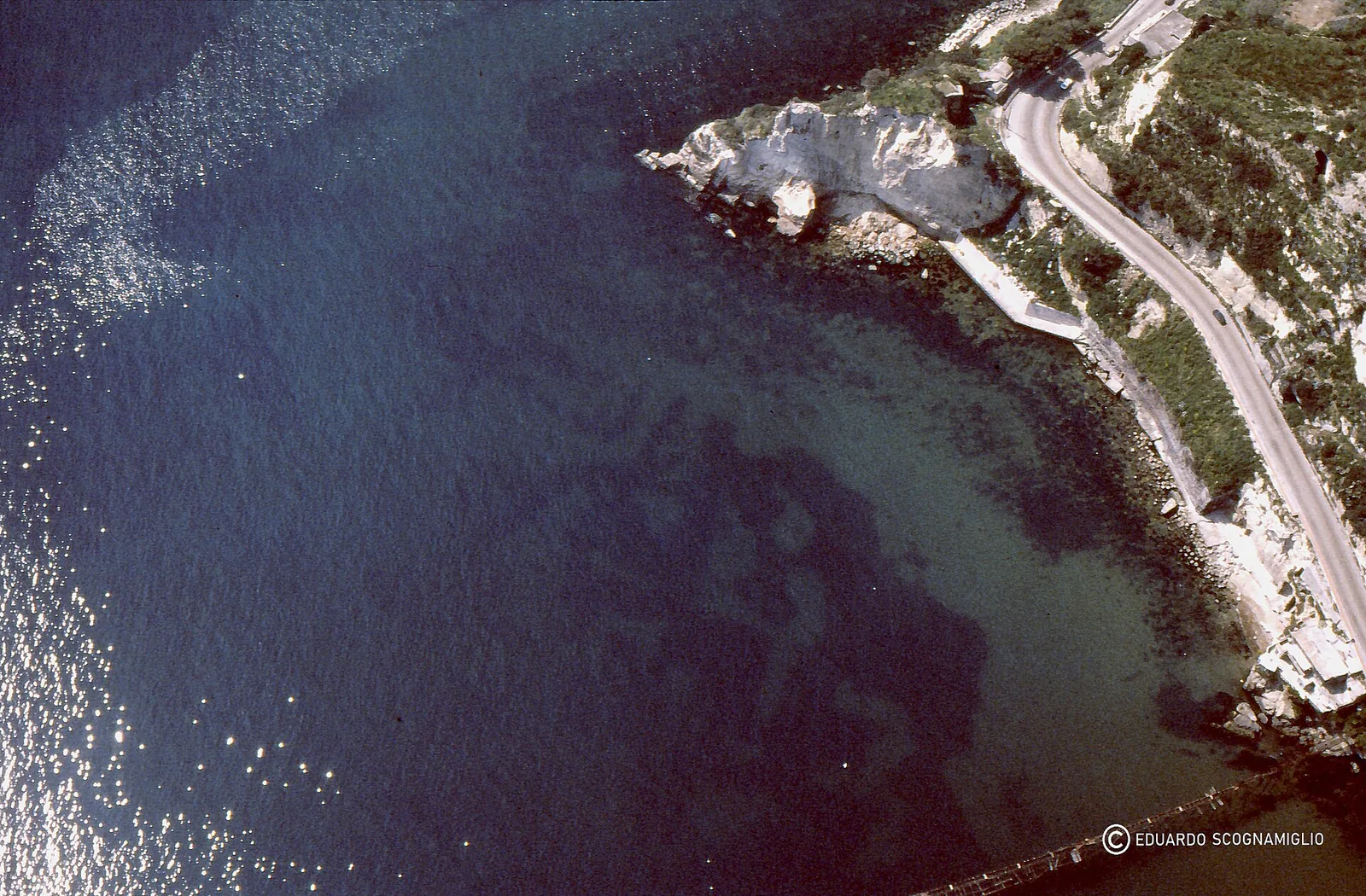
 40.821° N, 14.073° E


Complete guide
Spiaggia di Baia: beach guide
What the beach is like
Spiaggia di Baia belongs to the hamlet of Baia, in the municipality of Bacoli, metropolitan city of Naples, and is part of the Campi Flegrei. It is a sandy beach facing the Tyrrhenian Sea, in Campania, and at this point the coast faces east. The village of Baia is 0.2 km away as the crow flies.
The gulf of Baia is enclosed between the heights of punta Lanterna, where the castello Aragonese stands, and punta Epitaffio. The gulf is an ancient volcanic crater, dating back about 8400 years and only half preserved. The eastern part of the crater has sunk or been eroded by the sea. The ancient gulf of Baia now forms the western part of the gulf of Pozzuoli.
In Roman times Baia was a place of rest and holidays for Roman patricians, famous for its hot thermal waters. The Latin name Baiae derives from Balineae, meaning public baths. The lower part of the town was largely submerged by the sea by the 8th century.
Getting there
For those arriving by train there is the Cumana railway of the EAV line from Napoli Montesanto towards Torregaveta. The suggested stop is Lucrino station, from where the Baia pier can be reached on a walk of about 15 minutes along the coast or by a local shuttle bus. By car, take the Tangenziale di Napoli (A56) towards Pozzuoli to exit 14 Arco Felice / Pozzuoli / Bacoli, then follow the signs for Bacoli and Baia up to the pier on via Lucullo. By bus, use the EAV intercity buses to Bacoli and Monte di Procida, getting off at the Baia - Molo/Porto stop on via Lucullo.
The Cumana also has stations at Fusaro, on via Ottaviano Augusto, and Torregaveta. Fusaro lies 0.9 km west of the beach as the crow flies. In 2023 the port of Baia was listed as a stop for the Alilauro Archeolinea from Naples, Pozzuoli, Procida and Ischia. For those arriving by boat, in 2023 seasonal moorings were listed at the south pier of Baia. Pozzuoli lies 4.2 km east of the beach as the crow flies, Bacoli 2.7 km to the south.
When to go
The beach is exposed to the grecale, levante and scirocco winds, which blow from the sea. With these winds, waves and rough water near the shore are more likely. With the libeccio, ponente and maestrale, on the other hand, the wind blows from land and the beach is sheltered, with generally calmer water near the shore. The tramontana and ostro blow across the beach. This is an indication based on the orientation of the coast, not a forecast.
According to Italia.it, the Parco sommerso di Baia can be visited all year round, with more than 10 visitor routes. The destinations include the nymphaeum of Emperor Claudius, the Villa dei Pisoni and the villa with the protiro entrance. Before going, it is worth checking the weather and sea conditions.
Seabed and sea
The beach has a sandy bottom. For this beach, QualeSpiaggia data do not report an EEA water quality class.
The Parco sommerso di Baia preserves, over an area of 180 hectares and at depths of between 4 and 8 metres, the remains of villas, thermal baths, roads and harbours from the Roman era. They ended up on the seabed because of bradyseism, a volcanic phenomenon typical of the Campi Flegrei. The nymphaeum of Emperor Claudius is completely submerged. In Roman times the gulf was a coastal lagoon, the Baianus lacus, linked to the sea by a channel 32 m wide between two piers about 230 m long.
In this area ancient ruins and seagrass meadows exist side by side. On 5 June 2025 an airborne bathymetric LiDAR survey mapped the seabed at a resolution of 1 m² or better. The structures identified include the entrance to the Portus Baianus, the Villa dei Pisoni and the Portus Julius. Octopus, groupers and gilthead bream swim among the tuff and brick walls.
Rules and protected areas
The Parco sommerso di Baia is a marine protected area in the Golfo di Pozzuoli, established as a protected area in 2002, which combines archaeological protection and environmental conservation. According to Italia.it it is the first site in Italy recognised as a worldwide “best practice” under the 2001 UNESCO Convention on the protection of the underwater cultural heritage.
Since 2001 the sites of the Park can be visited on guided scuba dives, snorkelling tours, glass-bottom boat trips and in a small tourist submarine. According to Italia.it, visits take place accompanied by specially trained diving experts. For those who prefer not to get wet, there are glass-bottom boats. Before swimming with mask and snorkel, it is advisable to check the rules in force in the protected area.
Nearby
The castello Aragonese di Baia stands on a tuff promontory rising sheer from the sea and was built at the end of the fifteenth century, in 1495, and thoroughly rebuilt in the years 1535-1550, during the period of urban and defensive renewal promoted by the Spanish viceroy Pedro Álvarez de Toledo. Today the castle houses the Museo Archeologico dei Campi Flegrei, with finds from Baia, Cuma, Puteoli and Liternum. The museum holds the sculptures from the nymphaeum of Claudius and the reconstruction of the nymphaeum found in the waters off punta Epitaffio. In 2026 the municipality's page gave the castle's opening times as Tuesday to Sunday, 9:00 to 17:30, with a full single-site ticket at 5 euros.
Punta Epitaffio lies 0.4 km north-east of the beach as the crow flies. The archaeological complex of Baia, part of the Parco archeologico dei Campi Flegrei, preserves what was the hilly part of the ancient town. The remains include domed structures such as the temple of Diana, the temple of Mercury and that of Venus. The dome of the temple of Mercury has a diameter of 21.5 m. The entrance is at via Sella di Baia 22; in 2026 a full single-site ticket cost 5 euros. The site is partially accessible to people with reduced mobility.
The nearest beaches are Spiaggia Villa Ferretti, 1 km to the south-east, and Spiaggia di Lucrino, 1.1 km to the north-east. 2.2 km to the west is Spiaggia di Torregaveta. Further south, 3.7 km away, is Spiaggia di Miseno. Cuma lies 2.4 km to the north-west as the crow flies.
Sources
- Wikipedia (it) — Baia (Bacoli)
- QualeSpiaggia — open data spiagge (CC BY 4.0)
- OpenStreetMap
- Wikipedia (en) — Baiae
- Parco sommerso di Baia - Comune di Bacoli
- Come arrivare - Comune di Bacoli
- Parco Archeologico Sommerso di Baia - Italia.it
- Progetto MER – Mappatura costiera: esplorazione delle meraviglie sommerse del Parco Archeologico di Baia — Italiano
- Le 6 meraviglie del Parco Sommerso di Baia, incanto archeologico subacqueo - Italia.it
- Il Castello Aragonese di Baia - Comune di Bacoli
- Complesso archeologico di Baia - Comune di Bacoli