
 41.206° N, 13.787° E


Complete guide
Baia Domizia beach (Sessa Aurunca): beach guide
What the beach is like
Baia Domizia is a seaside resort in Campania, on the Gulf of Gaeta, along the Domitian coast (litorale domitio), in the province of Caserta. It is a hamlet of both Sessa Aurunca and Cellole, on the border with Lazio, from which it is separated by the Garigliano river. The stretch of beach described here lies in the municipality of Sessa Aurunca. According to the Italian Wikipedia, in 1975 Cellole became an independent municipality, and when the resort was divided the southern and eastern parts, Baia Domizia Sud and Baia Felice, went to Cellole. The central area and the whole northern part up to the Garigliano river remained with Sessa Aurunca. The English Wikipedia instead dates Cellole's independence to 1973.
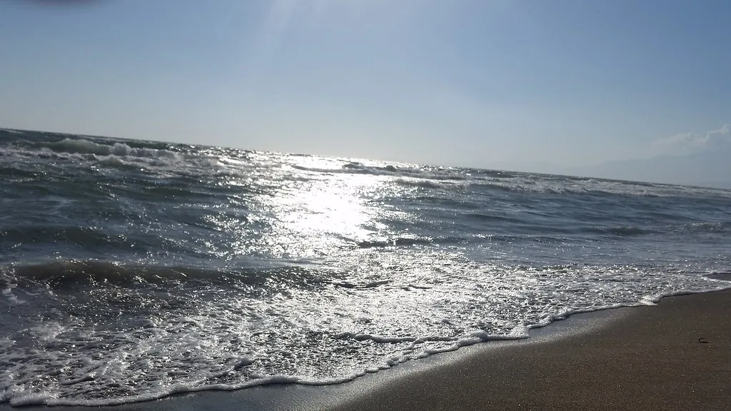
The sand and the beach are of volcanic origin, formed by the Roccamonfina volcano, now inactive. The beach is wide and sandy. Behind the sandy shore lies a long series of dunes which, further inland, give way to the pine forest. Within this area a network of paths makes it possible to visit all of its habitats.
The pine forest is largely man-made, planted during the various reclamation works in an area that was once marshland. Towards the sea, Mediterranean scrub dominates, still intact along more than 6 km of coast. The area is home to Romulea rollii, known in Italian as zafferanetto di Rolli, around ten species of orchids, mainly of the genus Ophrys, and the sea daffodil, Pancratium maritimum. Pioneer plants also grow on the dunes.
Baia Domizia is a planned town, designed from scratch and intended for tourism. In the 1960s the municipality of Sessa Aurunca, through a national competition, chose the Veneto company Aurunca Litora, chaired by the Paduan entrepreneur Giuseppe Longato. The final master plan was drawn up by the Paduan architect and urban planner Lorenzo Menegazzo, known as Renzo Men. The name comes from its position on the Domitian coast, the stretch of coastline running from Torregaveta to the Garigliano river along today's Via Domiziana.
Getting there
Baia Domizia can be reached via the SS7quater. The main internal avenues are all curved, and the smaller streets branch off from them. Those leading to the sea, which locals call pipette because of their shape, all end in a small open space. It is best to explore the resort on foot.
As the crow flies, Cellole lies 5.6 km east of the beach and Minturno 7.2 km to the north-west.
When to go
Visitors start arriving at Easter and numbers peak at the end of August. From September the drop is sudden, and in winter it becomes almost a ghost town.
The beach faces south-west. With the north wind (tramontana), the north-east wind (grecale) and the east wind (levante), the wind blows from the land and the sea close to shore tends to be calmer. With the south wind (ostro), the south-west wind (libeccio) and the west wind (ponente), the wind blows from the sea and the beach is exposed to waves. The south-east wind (scirocco) and the north-west wind (maestrale) hit it from the side. This is an indication based on the orientation of the coast, not a forecast.
Seabed and sea
In the 2025 season the water along this stretch was rated excellent by the EEA. Based on surveys carried out in 2014, Arpac had rated the cleanliness of the water as excellent. In May 2024 the FEE awarded the Blue Flag to the sea of Baia Domizia for the part within the municipality of Cellole. According to Wikipedia, it was the first award to a municipality in the province of Caserta.
Facilities and free beach
Besides hotels, there are campsites. In the northern area there is a shopping area with a small centre built in 1965 in Mediterranean style, known as the Centro Negozi. The resort has no hospitals: the nearest options are the Ospedale Civile San Rocco in Sessa Aurunca and the Pineta Grande Hospital in Castel Volturno. An ambulance and tourist medical service is run by Croce Amica Cellole.
Rules and protected areas
The last 4 km of the resort's coast lie within the regional park named after the Roccamonfina volcano and the mouth of the Garigliano. The park stretches from the Tyrrhenian coast, where the mouth of the Garigliano separates Campania from Lazio, up to the 1000-metre altitude of the Roccamonfina volcano. The resort also includes the special area of conservation of the pine forest at the mouth of the Garigliano, a European protected area for the conservation of natural habitats and species of flora and fauna. On the dunes it is best to use the existing paths and not trample the vegetation.
Nearby
In antiquity the pine forest at the mouth of the Garigliano was a sacred grove dedicated to the goddess Marica, whose temple stood on the opposite bank of the river, in the territory of Minturno. Just across the river lies the archaeological area of Minturnae, an ancient Roman town. At the mouth of the river, around the middle of the tenth century, the Lombard prince Pandolfo Capodiferro had the tower that bears his name built. The tower, which housed the Museo della Civiltà Aurunca, was destroyed in the fighting of 1943-1944 and still lies in ruins.
The Real Ferdinando bridge crosses the Garigliano shortly before its mouth. According to italia.it, it was the first bridge in Italy to rest on a single span. It is an iron suspension bridge built between 1828 and 1832 to a design by Luigi Giura, destroyed in the fighting of 1943-1944 and rebuilt only at the end of the twentieth century.
Along the coast to the north-west lie the Spiaggia di Monte d'Argento, 5.1 km away as the crow flies, and the Spiaggia di Scauri, 7.3 km away. To the south-east, the Spiaggia di Baia Felice is 6.7 km away as the crow flies. Baia Domizia lies at the heart of the production area of Falerno del Massico wine. Events in the resort include an international blues festival, now the Campania Blues Festival, held every July since 2006, and the Arena d'Arte, a sand sculpture festival first held in 2008.