
 40.508° N, 8.339° E


Complete guide
Cala Burantino: beach guide
What the beach is like
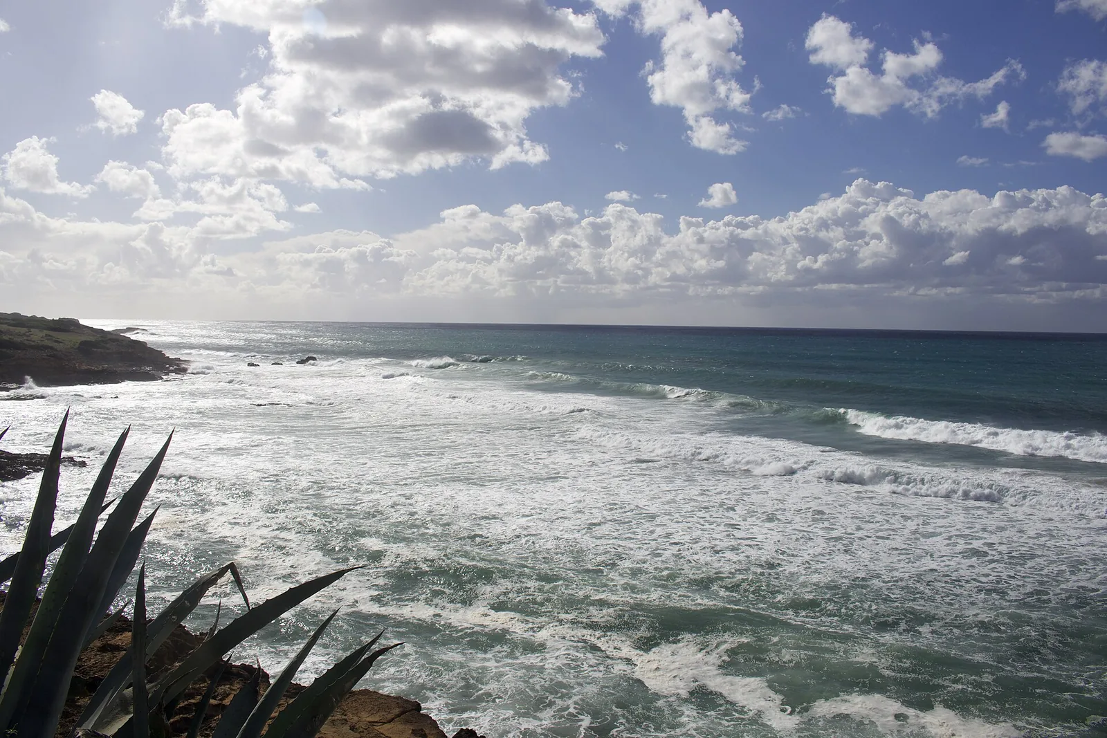
Cala Burantino, Burantì in the Algherese dialect, is an inlet on the north-western coast of Sardinia, in the roadstead of Alghero (rada di Alghero). It lies 6 km south of the town of Alghero as the crow flies, within the town's municipality. It faces the Sea of Sardinia (mar di Sardegna), on the Riviera del Corallo. Official maps use the form Burantinu, but over time the form Burantino has spread, while in archaic Algherese it was Bolantì.
The cove is closed by caletta Carla on its northern side and by Rampazzo on its southern side. Rampazzo is a point with three rocks breaking the surface, lined up perpendicular to the coast. The coast is mainly yellow sandstone, interspersed and in places fused with rocks of volcanic origin in a distinctive dark pink. The hinterland is almost entirely uninhabited and covered in Mediterranean scrub, with rosemary, myrtle, mastic, wild olive and dwarf palm. The most common animals include wild boar, fox, wild rabbit, falcon and land tortoise.
The inlet borders two inland areas, Burantinu and Maccaro. Burantinu stretches along the northern coast as far as the inhabited area of Padre Bellu, while Maccaro occupies the southern coast and continues inland. In the southern part of Maccaro there is a natural basin that collects rainwater. When it overflows, the excess water runs into the Riu Poglina, which reaches the sea beyond the spiaggia Burantino on the southern side, and into the Riu Nolli, which flows into the caletta Villa Wanda.
According to Italian Wikipedia, the cove includes two beaches and three small coves, while the English version mentions two beaches and two small coves. The spiaggia Burantino is surrounded by sandstone and magmatic rocks and has coarse ochre-yellow carbonate sand. Its size changes from year to year with storms and currents: its length varies from about 34 to 50 metres and its width from 5 to 15 metres. Over the 83 years between 1940 and 2023, the maximum size was recorded in 2008, at 98 metres long and 35 deep.
Getting there
Burantì is one of the coves along the road to Bosa. The coastal road from Alghero to Bosa is quite narrow and winding, with wide views. Fertilia lies 10.6 km north-west of the cove as the crow flies, and Alghero airport stands near it. Alghero is also served by the railway run by Arst, with the station of Alghero Sant'Agostino.
The sources consulted give no information on parking, paths or facilities for this cove. It is wise to bring water, shade and shoes suitable for rocks.
When to go
According to QualeSpiaggia data, the beach faces south-west. With the southerly (ostro), the south-westerly (libeccio) and the westerly (ponente), the wind blows from the sea and the beach is exposed to waves. With the tramontana, the north-easterly (grecale) and the easterly (levante), the wind blows from land and the cove is sheltered. The scirocco and the mistral (maestrale) hit it from the side. This is an indication based on the orientation of the coast, not a forecast.
Because of its geographical position, from the beach you can watch the sun set into the sea, sometimes with the rare green flash. For the beaches around Alghero, Wikivoyage names summer as the best time to go.
Seabed and sea
The seabed of the cove is mainly sandy. In front of the spiaggia Burantino it is shallow, partly sandy, and slopes down gradually over a long distance. The marine life is typical of the Mediterranean. In the 2025 season the bathing water was rated excellent by the European Environment Agency (EEA).
Nearby
The Caletta Villa Wanda, 0.1 km away as the crow flies, is formed by tall sandstone rocks and has a shallow sandy seabed. Near the shore of the small cove the seabed is shallow but soon becomes deep. The small cove is exposed to mistral (maestrale) storms and the Riu Nolli flows into it, so the beach appears and disappears unpredictably. Aerial surveys from 1940 to today show the beach only in some years.
Unlike the other small coves, Villa Wanda is made only of sandstone, and the Mediterranean scrub reaches almost to the sea. The coves of Carla and Arcamyrturs, by contrast, are lined with tall sandstone walls that merge with older pink volcanic formations.
Between the caletta Villa Wanda and the spiaggia Burantino lies the Bolantì quarry, which produced the calcarenite blocks known as massacà. These blocks were used to build the walls of Alghero and much of its historic centre. The quarry was part of the via del massacà, the coastal route linking Alghero to Bosa. Quarrying ended in the early 60s, but the break lines of the blocks can still be seen between the rock layers.
Beyond Rampazzo opens the cove of Torre Poglina, whose southern limit is the Scoglio di Poglina. Cala Griecas is 1 km to the south-east as the crow flies and the Spiaggia di Poglina 2.9 km to the south-east. From the cove you can see Capo Caccia, Punta Giglio and Monte Doglia to the north-west and Monte Minerva to the east. According to Wikipedia, Alghero is considered the capital of the Riviera del Corallo, a name linked to the red coral found in the waters of its roadstead, and in the town 22.4% of residents speak Catalan in its Algherese variety.
Sources
- Wikipedia (it) — Cala Burantino
- Wikipedia (en) — Cala Burantino
- Wikipedia (it) — Alghero
- Wikivoyage (it) — Alghero
- Wikivoyage (en) — Alghero
- OpenStreetMap
- EEA — Bathing water quality 2025 (IT020090003009)
- QualeSpiaggia — open data spiagge (CC BY 4.0)
- Porto Ferro | SardegnaTurismo - Sito ufficiale del turismo della Regione Sardegna