
 42.585° N, 14.090° E


Complete guide
Spiaggia di Torre del Cerrano: beach guide
What the beach is like
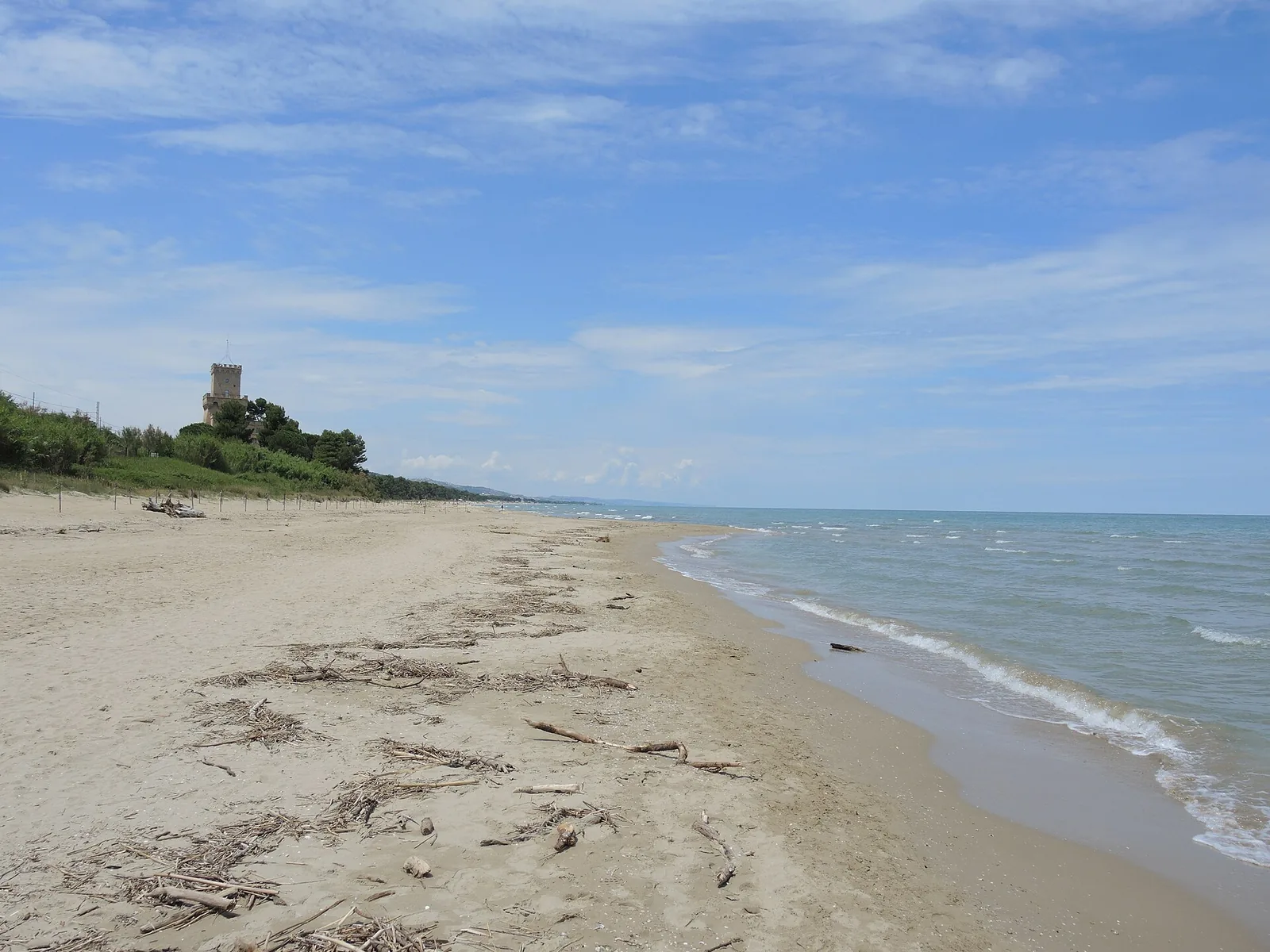
The Spiaggia di Torre del Cerrano lies in the municipality of Pineto, in the province of Teramo, in Abruzzo, on the Adriatic Sea. The beach is sandy. In 2026 the Torre Cerrano stretch appears in the list of Blue Flag (Bandiera Blu) beaches, compiled by the FEE, for the municipality of Pineto.
The Torre del Cerrano stands among the greenery of a large pine wood right behind the beach. The tower is one of the old coastal towers dating from the Kingdom of Naples, built to defend the territory against raids by Saracens and corsairs. It was enlarged in the sixteenth century by the Spanish viceroys Alvarez de Toledo and Parafan di Ribeira and, after being decommissioned for a time, it was restored in the last decade of the twentieth century. According to Wikipedia, the tower has been the symbol of Silvi and Pineto for more than 500 years and gave its name to the marine protected area.
According to Wikipedia, the protected area safeguards one of the few remaining stretches in Abruzzo with an almost intact dune environment. Psammophilous vegetation grows on the dunes, with sea daffodil, Gargano mullein, sea bindweed and purple spurge. The pine wood consists of stone pine and Aleppo pine, and the rare sand crocus also grows there. The area's points of interest include the coastal pine wood, a project by Luigi Corrado Filiani, and the dunes, that is, ridges of sand.
Getting there
The beach lies 3.1 km as the crow flies south-east of Pineto and 2.3 km north of Silvi. The address of the Torre del Cerrano is SS16, Km 431, Pineto.
According to Wikivoyage, Pineto has the Atri - Pineto exit on the Adriatic motorway (autostrada Adriatica) and is crossed by the Adriatic state road. Pineto also has a railway station of its own on the Adriatic line; the airports of Pescara and Ancona can be used. The Pineto coastline is followed along its whole length by a cycle path that is part of the Ciclovia Adriatica, which Wikivoyage describes as still under construction.
When to go
The Kentish plover (fratino) lives in the dune environment of the protected area, arriving in spring to nest and leaving again in autumn. This rare migratory bird can be seen on the beaches from April to September. It is advisable not to trample the dune vegetation.
The beach faces north-east. With the north wind (tramontana), the north-easterly (grecale) and the easterly (levante), the wind blows in from the sea and the beach is exposed to waves and rough water. With the southerly (ostro), the south-westerly (libeccio) and the westerly (ponente), the wind blows from the land and the beach is sheltered, with calmer water close to shore. The sirocco (scirocco) and the mistral (maestrale) blow across the shoreline instead. These are indications derived from the orientation of the coast, not weather forecasts.
Seabed and sea
The area's points of interest also include the sandy Adriatic seabed and some underwater reefs. The ancient port of Cerrano stood in this area: the port, of Roman origin, of the hilltop town of Atri. In the waters off the Torre del Cerrano, less than one kilometre from the shoreline, on a sandy seabed between 5 and 15 metres deep, lie the submerged ruins of the ancient port of Atri. They are the remains of an L-shaped pier, masonry, slabs of Istrian stone and columns. Diving is difficult, because the sand on the seabed often reduces visibility to a few centimetres.
The marine environment is home to the common clam, white sea bream, sea bass and the rare gastropod mollusc Trivia adriatica. In the 2025 season the European Environment Agency rated the bathing water quality of this stretch as excellent.
Rules and protected areas
The Torre del Cerrano marine protected area is the first marine protected area in Abruzzo and in the central Adriatic, and it was officially established on 7 April 2010, with its publication in the Gazzetta Ufficiale. It covers a coastal strip of about 7 km, between the mouth of the Calvano stream in Pineto and Piazza dei Pini in Silvi, which includes the beach. The area extends over 3,431 hectares, divided into 3 protection zones.
- Zone B covers the stretch of sea in front of the Torre del Cerrano and is the one with the most restrictions.
- Zone C protects the whole beach strip and extends out to sea up to 2 km from the coast.
- Zone D is the largest, reaches out to 3 nautical miles and contains the fish restocking areas of the Province of Teramo.
The regulation of the activities permitted in the different zones, approved by the ministerial decree of 28 July 2009, n. 218, lists bathing among the permitted activities. The same 2009 regulation limits navigation speed to 5 knots within the first 300 metres of sea from the coast and to 10 knots in the band between 300 and 600 metres. It allows access to small boats, with the exception of jet skis, water scooters and similar craft. In zone D it prohibits fishing with hydraulic dredges, trawling and spearfishing.
Nearby
According to the Italia.it portal, the Torre del Cerrano can also be visited inside, where it houses the Centro Internazionale di Formazione Veterinaria, a large library and the Museo del Mare. The Spiaggia di Quartiere delle nazioni lies 1.2 km as the crow flies to the north-west, while the Spiaggia di Silvi is 2.2 km to the south-east.
Mutignano lies 4.6 km as the crow flies west of the beach. With a royal decree of 11 December 1930 the seat of the municipality was moved from this hilltop hamlet to the new coastal settlement of Villa Filiani, and the municipality took the name Pineto. Atri lies 9.4 km as the crow flies to the west. Wikivoyage describes it as one of the oldest towns in the region, preserving a first-rate artistic heritage.
Sources
- QualeSpiaggia — open data spiagge (CC BY 4.0)
- FEE Italia — Bandiera Blu 2026, elenco spiagge
- Torre del Cerrano - Italia.it
- Wikivoyage (it) — Pineto
- Wikipedia (it) — Area marina protetta Torre del Cerrano
- EEA — Bathing water quality 2025 (IT013067035005)
- mase.gov.it — dm_28_07_2009_218_regolamento_torre_cerrano.pdf
- Wikipedia (it) — Pineto