
 36.802° N, 15.095° E


Complete guide
Vendicari beach: beach guide
What the beach is like
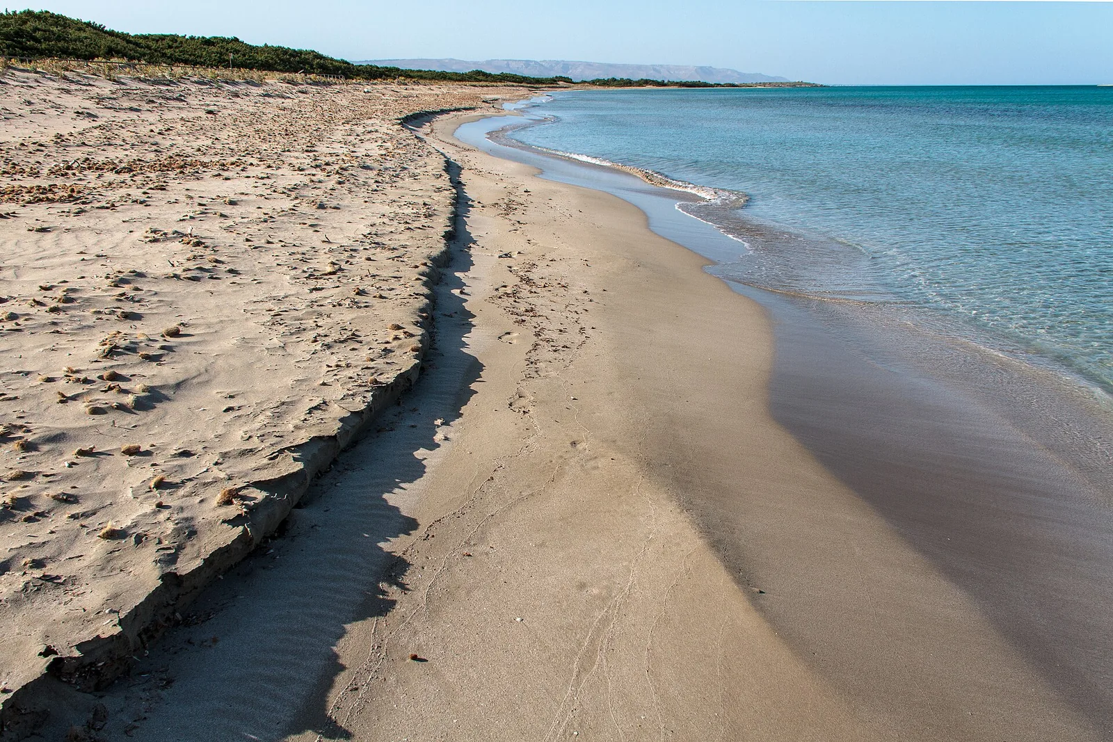
Vendicari beach lies in the municipality of Noto, in the province of Syracuse, in Sicily, on the Ionian Sea. It is one of the 5 beaches of the Oasi faunistica di Vendicari oriented nature reserve, each reached from an entrance with the same name. According to the body that manages the reserve, it is the largest beach in the whole protected area. The reserve is a narrow strip of land along the Syracuse coast, at the far south-eastern tip of Sicily, and runs for about 8 km of coastline between Noto Marina and the locality of San Lorenzo.
A good part of the beach is closed to visitors because it is a place where the loggerhead turtle (Caretta caretta) lays its eggs. The beaches of the reserve still keep their coastal dunes, partly protected by the typical vegetation. On the widest beaches a first belt of sand couch grass grows, while marram grass takes hold on the highest mobile dunes. Alongside these grasses live sea holly, sea spurge, sea knotgrass and the sea daffodil. Where there is no disturbance, a scrub dominated by prickly juniper develops on the innermost dunes.
Behind the coast the reserve is a wetland listed among the sites of international importance under the Ramsar Convention. The wetland is made up of three marshes, called Pantano Piccolo, Pantano Grande and Pantano di Vendicari.
Getting there
The beach lies 10.1 km as the crow flies south of Noto and 9.7 km north of Pachino. All the entrances to the reserve are reached from the SP19 provincial road, which runs from Noto to Pachino. The Vendicari entrance, located roughly in the middle of the reserve, is the main access point. From the entrance a walk of about 500 metres leads to the beach. Along the path, on the left, you can see the Pantano Grande with its salt pans and the old salt worker's house.
The reserve has 5 entrances in all: from the north Eloro, Marianelli, Calamosche, Vendicari and finally Cittadella, the southernmost. The path from the Cittadella entrance reaches the Case Cittadella farmhouse after 300 metres and, after another 300 metres, a fork, where on the right the route of about 3.5 km to the Tonnara begins. The managing body's price page, which refers to the 2015 access plan, also states that the ticket is valid on the day of issue and allows entry from any entrance of the reserve. Vehicles may not enter the reserve without authorisation.
When to go
The managing body's website, consulted for this guide, states that the reserve is open every day, except for temporary closures in the event of exceptional events. The entrances close one hour before the reserve closes, and staying inside is not allowed when the reserve is closed. In the event of weather alerts, fires or earthquakes the reserve may be closed as a precaution, with a notice on the website's home page. The managing body advises avoiding the hottest times of the day, or using suitable protection, and always carrying drinking water.
The reserve is also known as a birdwatching spot: in winter the osprey can be seen over the marshes, while in spring the white stork and the black stork pass through. The Pantano Piccolo, fed by a spring, does not dry out in summer, while the other two marshes fill up in the rainy season and only then host the large flocks of birds.
Judging from the orientation of the coast, the beach faces east. With the grecale, levante and scirocco winds the wind comes from the sea and the beach is exposed to waves and rough sea. With the libeccio, ponente and maestrale the wind blows from the land and the beach is sheltered, with calmer water close to shore. The tramontana and ostro, on the other hand, blow across the shoreline. This is an indication based on orientation, not a weather forecast.
Seabed and sea
The sea off the Vendicari area is a Site of Community Importance, called Fondali di Vendicari, because of an extensive posidonia meadow. Close to the shoreline no vegetation grows, but dead leaves and stranded fragments of posidonia are often found; this marine plant is particularly abundant on the seabed off the reserve. The felt-like balls seen in the sand are made of parts of posidonia roots, intertwined and shaped by the sea.
Sandy and rocky stretches alternate along the reserve's coast. In the 2025 season the European Environment Agency rated the bathing water quality of this stretch as excellent. The reserve's rules allow swimming only in certain areas.
Facilities and free beach
There is no medical post, drinking water point or refreshment point in the reserve, and toilets along the paths are not always available. For swimming, only an umbrella, a beach towel and a rubber ring or armbands may be used. Sunloungers, air mattresses, chairs of any kind, tents, beach games and inflatables may not be brought in. The managing body's price list, set by the access plan approved in 2015, provides for a full ticket at 3.50 euros, a reduced ticket at 1.50 euros and a family ticket at 7.00 euros. In the same 2015 price list, entry is free for children under 8 and for people with disabilities with a companion. On the same page that sets out the 2015 price list, the managing body states that only electronic payment is accepted at the entrances, not cash, and that visitors must keep their ticket for the whole visit.
Rules and protected areas
The reserve was established by a decree of the regional Land and Environment department on 14 March 1984. It is managed by the Department of Rural and Territorial Development of the Sicilian Region. The stated purpose of the reserve is to allow birds to stop over and nest and to restore the Mediterranean psammophilous (sand-dwelling) vegetation.
The rules of conduct published by the managing body prohibit:
- bringing in pets, and vehicles without authorisation;
- leaving litter, damaging or collecting plants, animals and materials;
- leaving the paths, camping out and lighting fires;
- fishing, hunting, disturbing or making loud noise;
- bringing in games, deckchairs and sunloungers, and using drones.
If you come across wild animals, the managing body asks you to leave them alone, not to approach them and to avoid shouting and sudden movements.
Nearby
From the path of the Vendicari entrance, turning left, you reach the old Tonnara di Vendicari, the Swabian tower, whose base is thought to date from the Swabian period, the fisherman's house and the remains of a Hellenistic fish-processing plant. Tuna fishing at Vendicari ended after the Allied landing in July 1943, when the nets were no longer lowered and the onshore plant was abandoned. Excavations of the fish-processing plant have uncovered twenty-five tanks, and it is thought to have been in use from the fourth to the first century BC.
Further north, 2.6 km as the crow flies, is the Calamosche beach, a cove between two rocky headlands reached by a path of about 1,200 metres from the entrance of the same name. According to the managing body, in 2005 the Calamosche beach received the title of 'Most beautiful beach in Italy' from Legambiente's Guida Blu. Further north still, 4.2 km away, the Eloro beach is reached by a walk of about 300 metres from the reserve's northern entrance, where the car park is, and along the way some ruins of the Greek city of Eloro can be seen.
Sources
- QualeSpiaggia — open data spiagge (CC BY 4.0)
- Riserva Naturale di Vendicari
- La Riserva di Vendicari Riserva Naturale Orientata
- Riserva Naturale Oasi faunistica di Vendicari - Regione Siciliana - Portale ORBS
- Riserva di Vendicari - Fauna e Flora
- Tariffe delle Riserva Naturali
- Norme di comportamento delle Riserva Naturali Orientate
- Orari di apertura delle Riserva Naturali Orientate
- Informazioni utili sulle Riserva Naturali Orientate
- Consigli utili per una corretta fruizione della Riserva naturale - RISERVE NATURALI SICILIA Vendicari Cavagrande Pantalica
- EEA — Bathing water quality 2025 (IT019089013018)
- Spiaggia di Eloro - Città di Noto