
 40.180° N, 9.634° E


Complete guide
Cala Sisine: beach guide
What the beach is like
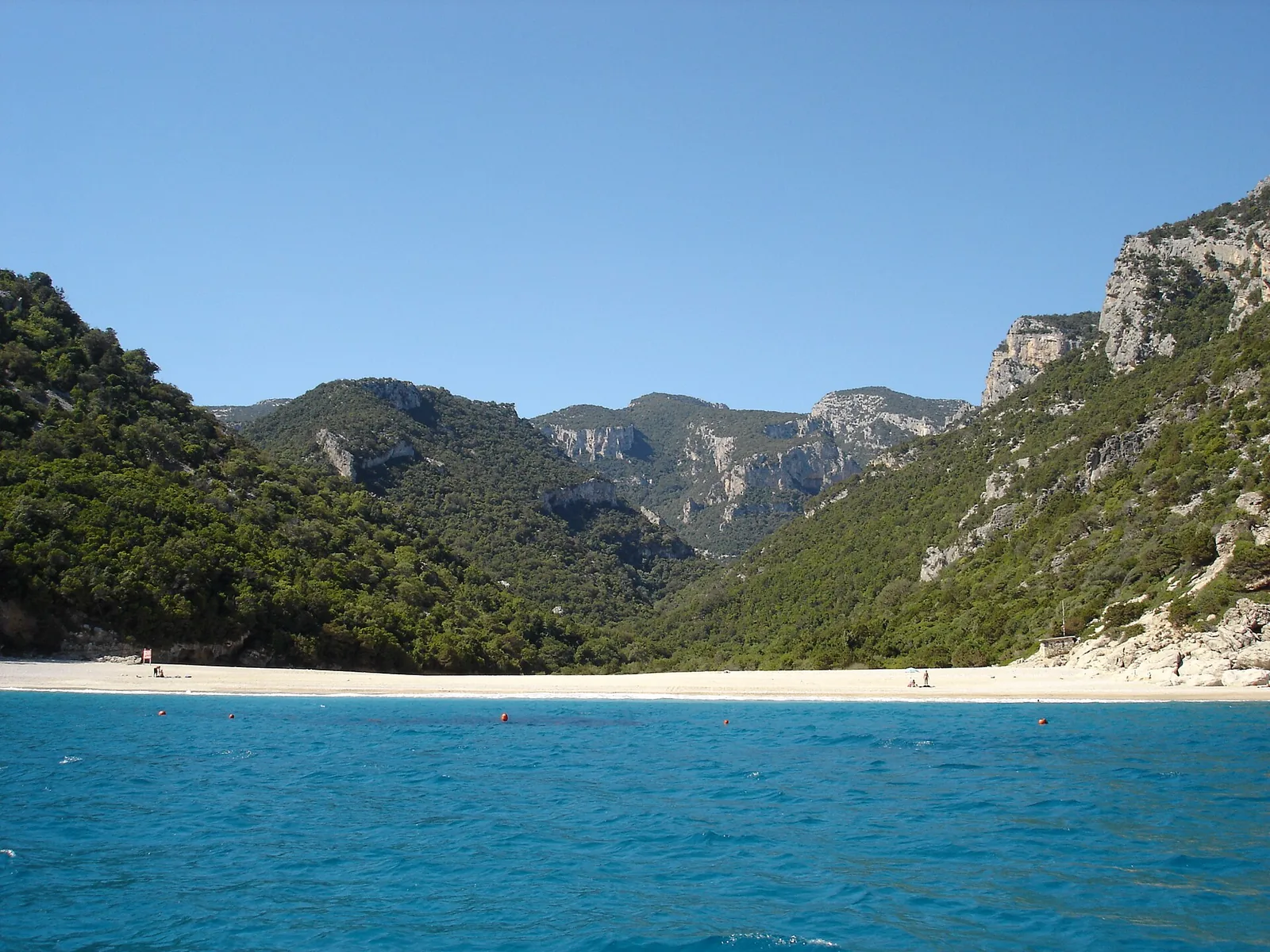
Cala Sisine is one of the coves of the Gulf of Orosei, in the municipality of Baunei. The cove lies at the end of a codula, a gully that was once a riverbed and is now the mouth of a small stream rising on the Golgo plateau, in the Supramonte of Baunei. The official tourism portal of the Regione Sardegna describes it as less well known than other coves of the gulf such as Luna, Goloritzè and Mariolu.
The sources use different measurements for its size. Wikipedia and the regional portal give its width as about 200 metres. The tourism website of the municipality of Baunei, on the other hand, describes it as more than 100 metres deep and about 500 long, and for this reason considers it the most spacious beach on the coast. The beach is made up of very white small pebbles.
The beach faces the cliffs of the Serra Ovra, which drop sheer into the sea from a height of more than 500 metres. It is flanked by rocky ridges, while the gorge is covered with centuries-old carob and holm oak trees. The beach lies between the rocky headland of Plummare, 415 metres high, and the coast of Dolài.
The beach did not exist until the middle of the nineteenth century. It is the result of rocky debris piling up at the mouth of the Codula di Sisine, a stream that swells with the winter rains and carries downstream whatever it meets along its course from the Golgo plateau to the sea. The maps of the Catasto La Marmora – De Candia, dated 1849 and kept in the Archivio di Stato di Cagliari, show in its place an inlet that reached hundreds of metres into the coast, a natural harbour. Today's beach is the result of floods after 1850, which pushed the shoreline forward until it joined the headlands of Plummàre and Dolài. A reproduction of the nineteenth-century map can be seen in the room of the Centro di Documentazione in Baunei dedicated to the land register.
In the past the place was known as portu 'e Sisine, a landing place for cargoes of charcoal, and a building put up by the charcoal burners still stands there. Tools found in the area date human presence here to about 4000 years ago. The Su Coile refreshment point was built in 1977 on the ruins of the charcoal burners' storehouse, and its main building takes its cue from the hut of the traditional Baunei sheepfolds. In the same years a campsite was set up in the small wood, later swept away by several floods in the nineties.
Getting there
By land, the starting point is the Golgo plateau. You follow the dirt road that branches off to the right 200 metres before the Chiesa di San Pietro. The road, about 13 km long, runs alongside the codula for long stretches up to the parking clearing of Planu 'e Murta, the myrtle plateau. Planu 'e Murta can only be reached by off-road vehicles. With an ordinary car you have to leave it in the parking area at Ololbissi and cover about 8 km to the beach.
From Planu 'e Murta a path leads to the beach in about half an hour. The municipal website speaks of just over one km on foot, while Wikipedia places Planu 'e Murta about two kilometres from the sea. Almost every year the winter rains badly damage the dirt road, which is then repaired at the start of summer. Before setting off, it is worth checking the condition of the road.
By sea, you can arrive by private boat or on services departing from the ports of Arbatax, Cala Gonone and Santa Maria Navarrese. In summer a small fleet of boats takes visitors along the coves of the gulf, leaving in the morning from La Caletta, Cala Gonone, Orosei, Arbatax and Santa Maria Navarrese and returning in the afternoon. Cala Gonone lies 11.4 km north of the beach as the crow flies.
When to go
According to QualeSpiaggia data, the cove faces north-east. With the north wind (tramontana), the north-easterly (grecale) and the east wind (levante), the wind blows in from the sea and the beach is exposed to the waves. With the south wind (ostro), the south-westerly (libeccio) and the west wind (ponente), the wind blows from the land and the sea close to shore tends to be calmer. The south-easterly (scirocco) and the mistral (maestrale) hit it from the side. This is an indication derived from the orientation of the coast, not a forecast.
Seabed and sea
The seabed is made of sand with light limestone grains and rounded stones, suitable for those who swim with mask and snorkel. The water is a turquoise that shifts with the reflections of the sun. There is also an inlet fifty metres high, used as a diving board by the most experienced divers. In the 2025 season the water at Cala Sisine was rated excellent by the EEA.
Facilities and free beach
The cove has a bar and a refreshment point. The regional portal's page lists admission as free. It is still a good idea to bring water and sun protection.
Nearby
In past centuries the cove was an obligatory stop before or after rounding the monti insani, so called by Cicero, from which the name of Capo Monte Santo derives. It is also said that during the Second World War a submarine used to stop at a sheltered spot called su Stuggiu, the hiding place.
Cala Biriala lies 3.8 km south-east as the crow flies. Cala Biriala is a small beach formed by a landslide beneath a sandstone wall, once frequented by monk seals. One stage of the Selvaggio Blu trek ends at Cala Sisine and also includes some abseils of forty to fifty metres. Cala Mariolu is 7.2 km south-east as the crow flies, Cala Luna 5.2 km north.
On the Golgo plateau, where the road to the cove starts, lie the sinkhole known as Su Sterru and the church of San Pietro del Golgo, an ancient place of worship, first Nuragic and then Christian. Baunei is crossed by the SS 125 Orientale Sarda, and Arst bus line 303 Arbatax-Nuoro stops there.
Sources
- Wikipedia (it) — Cala Sisine
- Wikivoyage (it) — Baunei
- OpenStreetMap
- EEA — Bathing water quality 2025 (IT020105003001)
- QualeSpiaggia — open data spiagge (CC BY 4.0)
- Cala Sisine | SardegnaTurismo - Sito ufficiale del turismo della Regione Sardegna
- Cala Sisine - Spiagge Costa di Baunei
- Cala Birìala - Spiagge Costa di Baunei