
 40.275° N, 9.632° E


Complete guide
Spiaggia di Cala Gonone: guide to the Dorgali coastline
What the beach is like
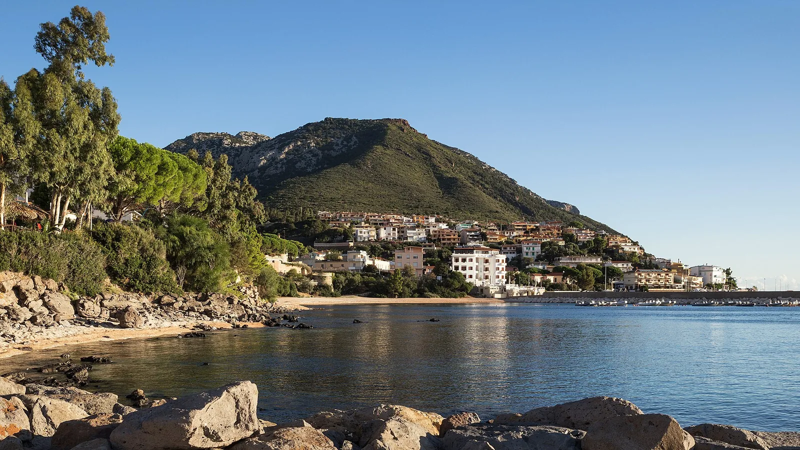
The Spiaggia di Cala Gonone lies in the municipality of Dorgali, in the province of Nuoro, on the Tyrrhenian Sea. The beach lies south of the village of Cala Gonone, 0.8 km away as the crow flies. According to Wikipedia, Cala Gonone is the only frazione (hamlet) of the municipality of Dorgali and has 1618 inhabitants. The hamlet of Cala Gonone is the only coastal settlement of the Gulf of Orosei south of Orosei, with the only small harbour. The limited human settlement, helped by the lack of a coastal road, has largely preserved the natural character of the area.
According to SardegnaTurismo, the official tourism website of the Sardinia Region, Palmasera is the widest stretch of shore in Cala Gonone, the seaside hamlet of Dorgali. Palmasera lies 0.6 km from the beach as the crow flies, to the north-east. At Palmasera gravel mixes with fine, light sand, and a few rocks break the surface a few metres from the shore. Palmasera is the natural continuation of the Sos Dorroles beach. Sos Dorroles, about a kilometre from Cala Gonone, has an orange and pink shore, owing to the wall of limestone debris that surrounds it and to the pinkish grains of imported sand. Next to Palmasera is the Spiaggia centrale, overlooked by an Art Nouveau (liberty) villa from the nineteen-twenties and regarded as the historic beach of Cala Gonone.
Getting there
From the SS 125 Orientale Sarda you continue to the junction for Cala Gonone, then take the tunnel and the winding SP 26 down to the village. The tunnel branches off the SS 125 and crosses the valley between Monte Bardia and Monte Tului. Once through it, Cala Gonone comes into view from a panoramic point, and a few kilometres of descent with some hairpin bends lead down to the village. Palmasera is reached by following the scenic state road 125 and turning towards Cala Gonone, with the beach signposted close to the village. Sos Dorroles is reached via a turn-off along the scenic viale Bue Marino, which runs from the village along the shore towards the southern coves.
According to Wikivoyage, in the summer period Olbia airport is linked to Cala Gonone by Deplano buses, with intermediate stops including Orosei and Dorgali. The same source also lists the ARST 520 bus line.
When to go
The hamlet of Cala Gonone enjoys the climatic benefits of the sea, with mild winters and hot, dry summers. The area is often swept by strong mistral (maestrale) winds, in irregular gusts and from changing directions. The wind from the north-west funnels into the mountain gorges and is then reflected back from the south-east. The mountains, on the other hand, partly shelter the area from bad weather coming from the west. Often, when heavy rain falls on the slope towards Dorgali, it does not rain in Cala Gonone, or rains only very lightly.
According to QualeSpiaggia data, calculated from the orientation of the coast, the beach faces south-east. Based on orientation alone, it is sheltered with the westerly ponente and the northerly tramontana, which blow from the land. According to the same exposure data the mistral would also blow from the land, but Wikipedia notes that here the north-westerly wind is then reflected from the south-east. The easterly levante, the scirocco and the southerly ostro, by contrast, blow from the sea and can bring waves and rough water close to shore. The grecale and the libeccio blow across the shoreline. This is an indication derived from the orientation, not a forecast: before setting off, it is worth checking the wind of the day.
Seabed and sea
In the 2025 season the bathing water of this stretch was rated good by the European Environment Agency. According to SardegnaTurismo, along this shoreline the sand mixes with pebbles and gravel, while QualeSpiaggia data, derived from OpenStreetMap, give the beach a sandy bottom. The seabed at Sos Dorroles slopes gently out to sea and is popular with spearfishers and snorkellers for its clarity and its rich fish life. At Palmasera the seabed is shallow and slopes gently.
Facilities and free beach
Palmasera has parking, access for people with disabilities, refreshment points and rental of umbrellas, deckchairs and boats. Sos Dorroles, by contrast, is moderately busy and has limited parking. The southernmost stretch of Sos Dorroles is equipped to welcome dogs: it is the s'Abba meica dog beach. The name means "the medicinal water" and recalls a spring that centuries ago was believed to have healing properties.
The hamlet of Cala Gonone has guesthouses, hotels, bed & breakfasts, holiday homes, a campsite and an equipped area for campervans. Life in the resort revolves around the seafront close to the small harbour, with bars and restaurants.
Rules and protected areas
More than half of the Gulf of Orosei lies within the Golfo di Orosei e del Gennargentu national park, a protected area of more than 74000 hectares. According to Wikivoyage, the coves of the gulf can also be visited by renting a dinghy without a skipper, driving responsibly. A licence is required only for boats with more than 40 horsepower. The Grotte del Bue Marino contain protected Neolithic rock carvings.
With children
According to SardegnaTurismo, the shallow, gently sloping seabed makes Palmasera suitable for children. Sos Dorroles is also listed as suitable for children. On stretches with pebbles and gravel, water shoes can be useful. In 2010 an aquarium opened in Cala Gonone, in the area called La Favorita, with more than 20 display tanks.
Nearby
To the south lie the Ziu Martine beach, 1.8 km away as the crow flies, and Cala di Fuili, 2.2 km away. Ziu Martine is a stretch of about 300 metres, almost half of it large rocks, with almost no sand and made up of limestone and volcanic pebbles. Its seabed is very clear and stony and popular with snorkellers. Cala Fuili is the last cove that can be reached by car or bike from Cala Gonone: the road ends where the walk down begins. You get there by descending a flight of steps cut into the rock and crossing a dense wood of Mediterranean scrub. From the southern side of Cala Fuili a path leads to the Bue Marino caves, the Oddoana cove and Cala Luna.
Cala Luna, 5.5 km to the south as the crow flies, is shared with the municipality of Baunei. From the harbour of Cala Gonone skippered excursions leave for Cala Luna, Cala Sisine, Cala Mariolu and Cala Goloritzè. There is also a sea taxi service to reach a particular beach of the gulf or to return to Cala Gonone after a trek. The Grotte del Bue Marino were a place of shelter, mating and birth for the monk seal, hence the name. The part fitted out for tourist visits is reached by sea from Cala Gonone. On top of a headland stands the single-tower Nuraghe Mannu, built with large blocks of volcanic rock and basalt, 200 metres sheer above the sea.
Sources
- QualeSpiaggia — open data spiagge (CC BY 4.0)
- OpenStreetMap
- Wikipedia (it) — Cala Gonone
- Palmasera - Cala Gonone | SardegnaTurismo - Sito ufficiale del turismo della Regione Sardegna
- Sos Dorroles | SardegnaTurismo - Sito ufficiale del turismo della Regione Sardegna
- Wikivoyage (it) — Cala Gonone
- EEA — Bathing water quality 2025 (IT020091017009)
- Cala Gonone - Italia.it
- Cala Fuili | SardegnaTurismo - Sito ufficiale del turismo della Regione Sardegna