
 39.186° N, 9.152° E


Complete guide
Spiaggia di Calamosca: beach guide
What the beach is like
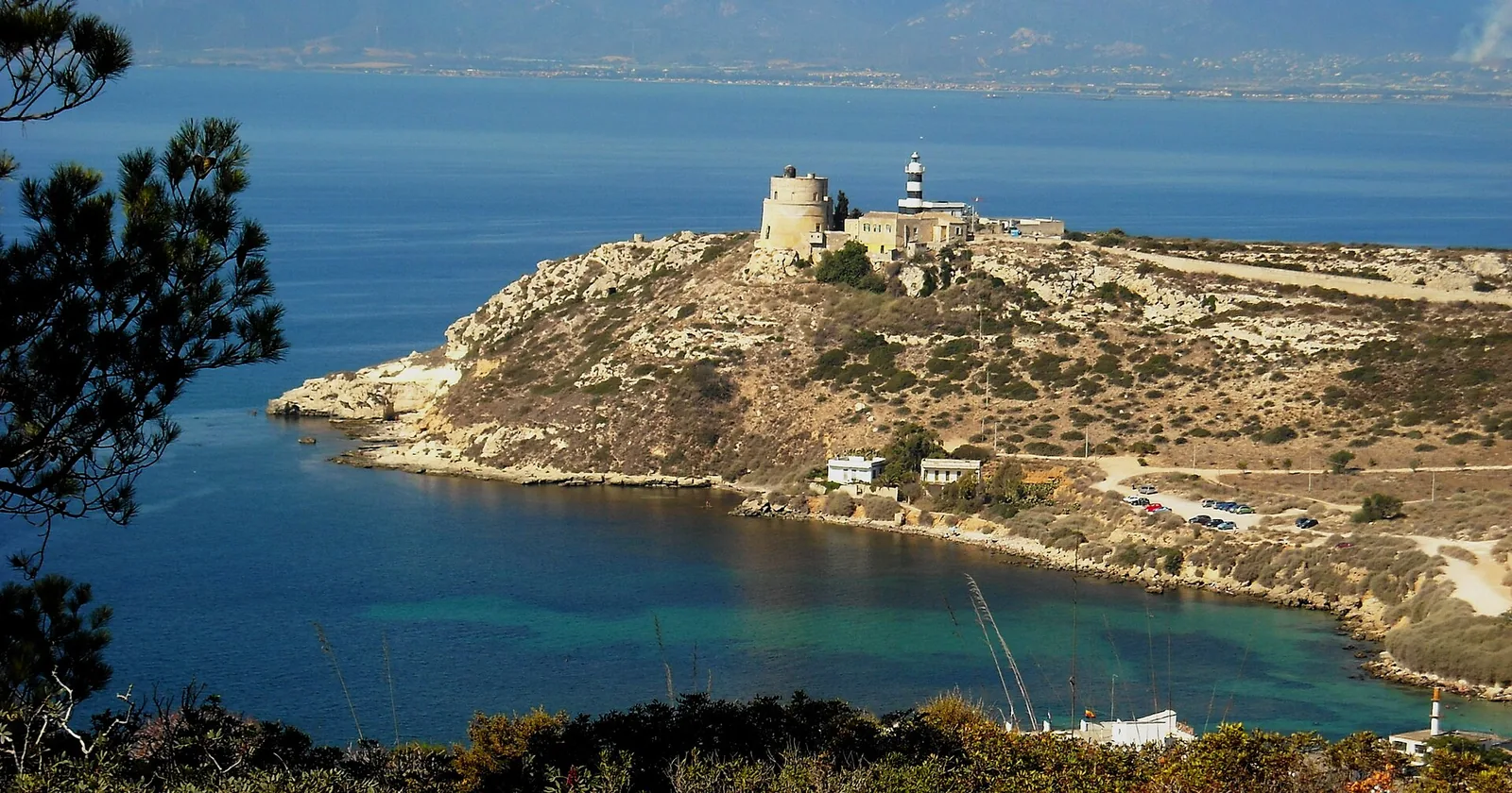
Calamosca is a beach in the municipality of Cagliari. According to SardegnaTurismo, the tourism portal of the Sardinia Region, it lies just four kilometres from the city centre. It sits in the middle of a small inlet closed off by a rocky cliff and by the Sant'Elia hill. Calamosca is a small sandy beach surrounded by cliffs, between Capo Sant'Elia and the Poetto. As the crow flies, the centre of Cagliari is 4.8 km to the north-west. The beach lies right next to the long, wide sandy shore of the Poetto, which Wikivoyage names as the main beach of Cagliari.
The shore is sand with smooth pebbles; SardegnaTurismo describes clear water, in shades ranging from emerald green to blue. The bay is sheltered by two headlands: Capo Sant'Elia, with an old lighthouse, and the Sella del Diavolo. The name Sella del Diavolo (Devil's Saddle) comes from its distinctive shape, which legend attributes to Lucifer's fall onto its summit.
Nearby stands the Calamosca tower, built by the Spanish in the seventeenth century as part of the defensive system against Barbary raiders in the Gulf of Cagliari. In the late eighteenth century it came under French attack during the French expedition to Sardinia. Cagliari Turismo dates the construction of the tower to 1638 and explains that it is known as the signal tower, or signal station, because of a signalling system that allowed it to communicate with the castle of Cagliari. The tower stands on Capo Sant'Elia, near the lighthouse.
Getting there
Calamosca can be reached by bus or by car. By car, you take viale Armando Diaz, turn right into via San Caboto and immediately left into viale Salvatore Ferrara, towards viale San Bartolomeo, which then becomes viale Calamosca. There is a large car park.
As for public transport, in summer 2020 the Municipality of Cagliari announced that CTM line 11 was running daily to Calamosca. The same 2020 notice referred to the Busfinder app and the CTM website for timetables. Before setting off, it is worth checking current routes and timetables.
When to go
Cagliari Turismo describes the beach as very well sheltered from the mistral (maestrale). QualeSpiaggia data, which show it facing south, also indicate that the beach is sheltered from the mistral, the tramontane (tramontana) and the gregale (grecale), which blow offshore: with these winds the sea close to the shore tends to be calmer. It is, however, exposed to the sirocco (scirocco), the south wind (ostro) and the libeccio, which blow in from the sea and can bring waves. The levante and the ponente hit it side-on. This is an indication based on orientation, not a forecast.
In Cagliari the mistral and the sirocco blow frequently, sometimes, especially the former, at up to 100 km/h.
Seabed and sea
Calamosca faces the Tyrrhenian Sea. In the 2025 season the European Environment Agency (EEA) rated the bathing water quality at the monitoring point associated with the beach as good. The seabed slopes gently. Both SardegnaTurismo and Cagliari Turismo write that the beach is very popular with spearfishers and divers.
Facilities and free beach
According to Cagliari Turismo, during the summer season the beach has a kiosk bar and a beach equipment rental. The same page reports two open-air nightclubs in the immediate vicinity, open only in the warm season, and a three-star hotel with a restaurant, open all year round. SardegnaTurismo also mentions seafood restaurants in the inlet.
With children
SardegnaTurismo describes the gently sloping seabed as suitable for children. When the sea is rough, it is best to stay where you can touch the bottom.
Nearby
From the beach a small path climbs to the top of the headland of the Calamosca tower, with views over the Golfo degli Angeli. With suitable gear and footwear, SardegnaTurismo suggests continuing along the cliffs towards the Sella del Diavolo, past small inlets, as far as Cala Fighera, which has a rocky seabed. Cagliari Turismo describes the sea at Cala Fighera as ranging from turquoise to emerald green and, in the first stretch, a shallow, pebbly seabed.
The trails that explore the Sella del Diavolo also start from the open area next to the small Calamosca beach. The headland, an offshoot of the Sant'Elia hill, occupies the centre of the Golfo degli Angeli. Along the way grow dwarf fan palms, junipers, wild olives, mastic trees and spurges, and the headland shelters the peregrine falcon, the kestrel and the Barbary partridge. The natural caves around the cape have yielded traces of human presence dating back to the Neolithic. On the highest point stand the ruins of a Punic temple dedicated to Astarte. Two cisterns can also be seen, one of Punic origin and a smaller one from the Roman period. Along the hike there are also a watchtower of Spanish origin and some Second World War military structures, including a small fort. According to SardegnaTurismo, the name Poetto may derive from that of the tower, called pouhet in Catalan, meaning little well. The route is marked with green dots and was laid out in the early two thousands by environmental associations with the help of the autonomous maritime military command of Sardinia, which owns the military property on the headland.
Sources
- Wikipedia (it) — Calamosca
- Calamosca | SardegnaTurismo - Sito ufficiale del turismo della Regione Sardegna
- Spiaggia di Calamosca | Cagliari Turismo
- OpenStreetMap
- QualeSpiaggia — open data spiagge (CC BY 4.0)
- Wikivoyage (it) — Cagliari
- Calamosca Tower | Cagliari Turismo
- Comune di Cagliari | Servizio CTM dal primo luglio 2020
- EEA — Bathing water quality 2025 (IT020092009009)
- Cala Fighera Beach | Cagliari Turismo
- Sella del Diavolo | SardegnaTurismo - Sito ufficiale del turismo della Regione Sardegna
- Historic-Naturalistic Path On The Devil's Saddle | Cagliari Turismo