
 42.769° N, 10.407° E


Complete guide
Spiaggia di Barbarossa: guide to the beach at Porto Azzurro
What the beach is like
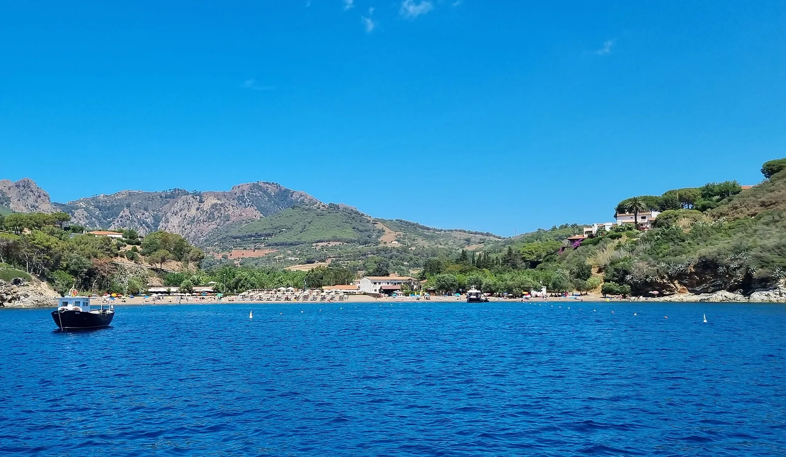
The Spiaggia di Barbarossa lies on the island of Elba, in the municipality of Porto Azzurro, in the province of Livorno. It sits in a bay on the south-eastern side of the island. 1 km as the crow flies west of the beach is the village of Porto Azzurro. The village stands in the middle of the Golfo di Mola, on the eastern coast of Elba.
Wikipedia describes a shore of dark, fine and smooth gravel mixed with sand. The beach is about 160 metres long and 30 metres wide. Visit Tuscany, the official website of the Tuscany destination, and the Italia.it portal describe it instead as sandy. In QualeSpiaggia data, taken from OpenStreetMap, the surface is classified as pebbles. On either side there are rocky inlets, which Wikipedia recommends to snorkelling and diving enthusiasts.
There are several theories about the origin of the name. One links it to the Turkish pirate Khayr al-Din Barbarossa, who landed on Elba in the sixteenth century. Another derives it from the red colour of an earth cliff above a small cove to the left of the beach, which can be reached by swimming. According to this hypothesis, from a distance the cliff looks just like a beard.
According to Wikipedia, the beach is fairly busy, being the closest one to the village of Porto Azzurro, but not excessively crowded. The beach is enclosed by the headland on which Forte Longone stands and by the spiaggia di Reale. The spiaggia di Reale lies 0.7 km to the east as the crow flies.
Getting there
A panoramic walk links the beach to the village, running along the perimeter of the walls of the seventeenth-century Forte Longone. The Italia.it portal suggests taking the passeggiata Carmignani, an easy nature trail. Within one kilometre you reach the Barbarossa beach. Visit Tuscany writes that Barbarossa is reached via the passeggiata Carmignani and calls it a fine, equipped panoramic path.
According to Wikivoyage, Porto Azzurro can be reached by car from Rio Marina and Portoferraio on the SP 26 road. For buses, the same source gives line 117. According to Visit Tuscany, the village has a well-sheltered harbour where ferries and tourist boats can dock. Portoferraio lies 8 km to the north-west as the crow flies. Comfortable shoes and water are useful for the walk.
When to go
According to Wikipedia, the beach is sheltered from the winds, except those from the south. Judging from the orientation of the coast, the beach faces south-east. Based on orientation, it is sheltered from the tramontane (tramontana), the west wind (ponente) and the mistral (maestrale), which blow from the land. The east wind (levante), the sirocco (scirocco) and the south wind (ostro), on the other hand, come from the sea and can bring waves and choppy water close to shore. The north-east wind (grecale) and the south-west wind (libeccio) blow across the shore. This is an indication, not a forecast.
According to Visit Tuscany, the Festa della Madonna di Monserrato is celebrated every year on 8 September.
Seabed and sea
In the 2025 season the European Environment Agency rated the bathing water along this stretch as excellent. The sea is the Tyrrhenian (Tirreno). Porto Azzurro lies on the coast of Elba and faces the Canale di Piombino. Visit Tuscany writes that at Porto Azzurro the seabed is perfect for diving enthusiasts, with underwater landscapes within reach of professionals and beginners. Wikivoyage also notes that scuba diving is possible at Porto Azzurro. Water shoes can be useful.
Facilities and free beach
According to Wikipedia, the beach offers numerous services on land, with bars and restaurants. At sea, according to the same source, it offers long seabed excursions and tourist routes around the whole island. According to Italia.it, Porto Azzurro is also home to the island's first dog beach, at Mola.
Nearby
The Fortezza di San Giacomo, also known as Fortezza di Longone, was built by Don Garcia de Toledo in 1603 on top of the headland overlooking the village. Its bastions and star-shaped plan follow the design of the fortress of Antwerp, and the village grew up at its foot. Visit Tuscany describes it today as a prison that can only be partly visited. The village was called Longone until 1873 and Porto Longone until 1947. The name Porto Longone was linked to the prison housed in the Fortezza di Longone, and in 1947 the local administration chose the new name Porto Azzurro.
To the south-west lie the Spiaggietta Carmignani, 0.8 km away as the crow flies, and La Pianotta, 0.9 km away. At La Pianotta sand alternates with rocks. Further on, also to the south-west, is La Rossa, 1.1 km away as the crow flies, which Visit Tuscany lists among the sandy beaches of the municipality. The spiaggia di Terranera lies 1.1 km to the north-east as the crow flies. It is a gravel beach with a small lake of mining origin. Capoliveri lies 3.7 km to the south-west as the crow flies.
Visit Tuscany points out, about one kilometre from the centre of Porto Azzurro, the Piccola Miniera, a small-scale reconstruction of a mine. A small train runs along a 250-metre route inside a reinforced tunnel. On an isolated height not far from the village stands the Santuario della Madonna del Monserrato, commissioned by the Spanish governor Pons y Léon in 1606. It was intended for the cult of the Black Madonna, venerated in Spain at the Sanctuary of Montserrat. In the old town stand the Chiesa della Madonna del Carmine and the Cappella del Sacro Cuore di Maria, both from the eighteenth century. Visit Tuscany describes piazza Matteotti, which looks onto the sea, as surrounded by shops and restaurants.