
 42.737° N, 10.187° E


Complete guide
Spiaggia di Cavoli: beach guide
What the beach is like
Cavoli is a beach on the south-western coast of the island of Elba, between the municipal seat Marina di Campo and the hamlet of Seccheto. It belongs to the municipality of Campo nell'Elba, in the province of Livorno. The beach of Seccheto lies 0.9 km to the west as the crow flies, the village of Marina di Campo 3.9 km to the east.
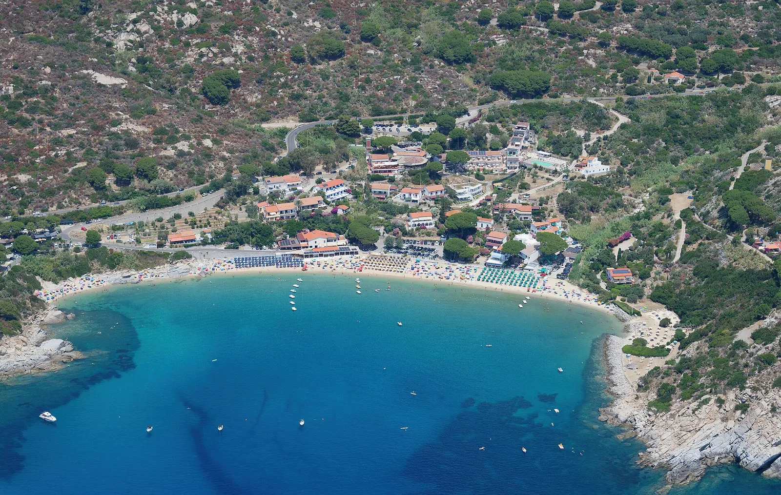
The beach is three hundred metres long and has a white, sandy seabed, formed by the crumbling of the monzogranite typical of this part of the island. The beach is divided by smooth granite rocks. Visit Tuscany, the official tourism portal of Tuscany, describes it as a bay sheltered from the winds, with light, soft sand that turns the sea an intense blue. The right-hand part of the beach alternates sandy stretches with large smooth rocks, from which you step straight into water that quickly becomes deep.
The name comes from the Latin cavulae, that is, from the granodiorite quarries documented since the first century. Towards the middle of the shore stands the building known as the Arsenale, begun in 1835 by the Pisani family and later altered by building additions. Next to this building is Casa Zimmer, lived in from 1907 to 1914 by the German Zimmer family, owners of the monzogranite quarries of Cavoli and Seccheto; according to Wikipedia it has now been turned into a place to eat and drink.
Getting there
The beach is reached from Marina di Campo along the coast road. According to Italia.it, the municipal territory is connected to the mainland by the airport of La Pila. La Pila, a hamlet of Campo nell'Elba, is the location of Marina di Campo airport. La Pila lies 4.8 km north-east of the beach as the crow flies. Portoferraio lies 14.5 km to the north-east as the crow flies. Before setting off it is worth finding out about the available parking.
When to go
According to QualeSpiaggia data the beach faces south. Because of this orientation it is sheltered from the tramontane (tramontana), the gregale (grecale) and the mistral (maestrale), which blow from the land: with these winds the sea near the shore tends to be calmer. It is, on the other hand, exposed to the sirocco (scirocco), the ostro and the libeccio, which blow from the sea and can bring waves. The levante and the ponente strike it side-on. This is an indication derived from the orientation of the coast, not a forecast. Wikipedia attributes a mild climate to the bay because of its sheltered position.
Seabed and sea
Cavoli looks out onto the Tyrrhenian Sea. In the 2025 season the European Environment Agency (EEA) rated the bathing water quality at the monitoring point associated with the beach as excellent. The seabed is white and sandy. In the right-hand part of the beach, however, the water quickly becomes deep.
Traces of the past have also come out of the sea: during a storm surge on 21 December 1989 a column emerged from the sandy seabed of the bay, and it now stands in the public gardens of Cavoli. The local historian Stoico Bonini wrote that during the great flood of 1947 he had seen large, already worked granite columns in the backwash of the waves on the beach, later covered again by the sand.
Facilities and free beach
According to Visit Tuscany, the beach offers equipped beach clubs, free areas, bars, restaurants, showers, water-sports equipment hire and spaces designed for families. Italia.it lists Cavoli among the seaside hamlets of the municipality with hotel facilities.
The non-technical summary of the Beach Use Plan (Piano di Utilizzazione degli Arenili) of the Municipality of Campo nell'Elba, dated March 2025, includes Cavoli among the beaches with areas under state-property concession, outside the boundary of the national park. The same document notes that at Cavoli there are privately owned portions of beach, behind the state-owned beach, with tourist or commercial businesses such as beach clubs, restaurants and hotels. For Cavoli the plan identifies areas where one beach club and two bathing assistance points, called Punti Blu, can be set up.
Nearby
Along the coast to the left, about six hundred metres from the bay, lies the Grotta Azzurra, once called Grotta di Mare. In the area there are rock formations such as Cote del Biondo and Pietra Rossa. On the eastern ridge, at Pietra Rossa, stood the small Quartiere Militare established by the Grand Duchy of Tuscany around 1817, now a private home.
At Grottarelle and along the Vie del Granito ecomuseum there are traces of the ancient working of monzogranite, an activity that dates back to the first century and continued under the Republic of Pisa in medieval times. Among the vegetation there remain ancient quarries with remains of columns and two roughly hewn circular basins, one of which has been called La Nave since the eighteenth century. On the heights above the beach is the Colonna di Cavoli, 7.86 m long and 1.10 m in diameter, which bears the inscription OPE, referring to the Opera della Primaziale Pisana. Near the beach of Cavoli is the site of the Colonne Romane, with numerous roughly hewn monolithic columns scattered among the vegetation, which bears witness to Elba's ties with the quarrying and working of granite. Elba granite is also found in the Pantheon and the Colosseum.
The beach of Fetovaia lies 2.8 km to the west as the crow flies. According to Visit Tuscany, Fetovaia is a bay in a narrow, deeply sheltered inlet, with very fine sand gathered into small light-coloured dunes. To the east, 1.4 km away as the crow flies, is the beach of Colle della Palombaia. The village of Sant'Ilario, inland, is 3.8 km to the north-east as the crow flies.
Sources
- Wikipedia (it) — Spiaggia di Cavoli
- OpenStreetMap
- QualeSpiaggia — open data spiagge (CC BY 4.0)
- Un tuffo nelle spiagge dell’Isola d’Elba | Visit Tuscany
- Campo nell'Elba - Italia.it
- Wikivoyage (it) — Campo nell'Elba
- EEA — Bathing water quality 2025 (IT009049003004)
- www.comune.camponellelba.li.it — VAS-PUA_RA-Sintesi-non-tecnica.pdf
- Le Colonne Romane a Campo nell’Elba - Italia.it