
 42.179° N, 14.685° E


Complete guide
Spiaggia di Punta Aderci: beach guide
What the beach is like
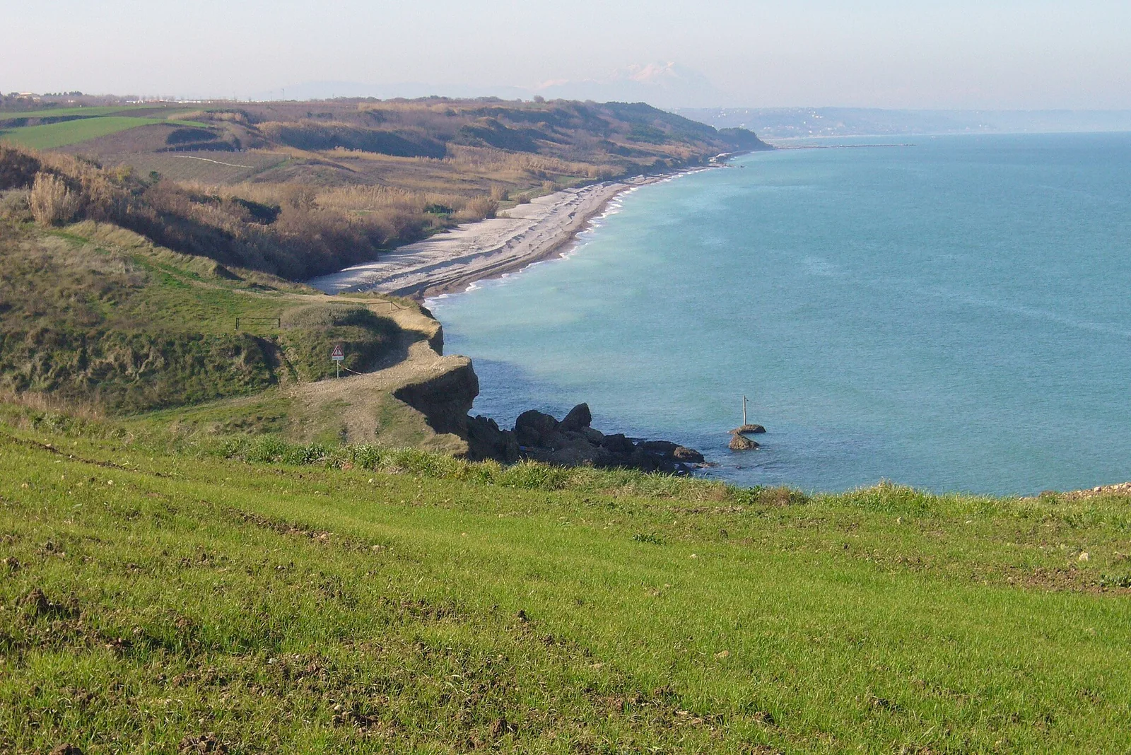
Spiaggia di Punta Aderci is in the municipality of Vasto, in the province of Chieti, and faces the Adriatic. It is one of the beaches of the Punta Aderci guided nature reserve, and shares its name with the trabocco of the same name, which is part of the system of the Costa dei Trabocchi. The reserve's beaches are, in order: Torre Sinello, Mottagrossa, Punta Aderci, the Libertini and Punta Penna. Along this shore, bays, coves, rocky cliffs and pebble and sand beaches alternate.
The reserve takes its name from the Punta Aderci headland, 26 m above sea level. The name is linked to archaeological remains dedicated to Hercules that once stood there. The headland offers a 360° view over the whole reserve, and the eye reaches as far as the Majella and, at sunset in good visibility, the Gran Sasso. From the Libertini beach a flight of steps climbs to the top of the cliff and to the Punta Aderci headland. On the other side of the headland another small beach opens up, and from there you continue towards Mottagrossa.
Behind the coast, the flat and hilly area is built up in places, but is mostly farmed with cereal grasses, olive groves and vineyards. Along the edges of the beach and at the foot of the cliffs run parallel dunes, made of fine sediment carried by waves and wind, on which dune (psammophilous) vegetation grows.
Getting there
The centre of Vasto is 6.4 km south of the beach as the crow flies and Casalbordino 8.9 km to the west. The reserve stretches from the mouth of the Sinello river, on the border with the municipality of Casalbordino, to the port of Vasto. It is crossed by several trails, including one that links it to the Bosco di Don Venanzio guided nature reserve, in the municipality of Pollutri. A section of the Adriatic cycle route (ciclovia Adriatica) also runs through it, following the former line of the Adriatic railway and crossing pine woods with plants typical of the Mediterranean maquis.
From the pebble beach of Mottagrossa to the mouth of the Sinello begins a wild area with 3 kilometres of scenic route, to be covered on foot or by mountain bike through pine woods, valleys and Mediterranean maquis. It is worth getting the trail map provided by the reserve's management. Towards the mouth of the Sinello you come across the brick arches that once marked the railway line, and from there the trail along the river begins. OpenStreetMap has no data on parking, showers or accessibility for this beach.
When to go
According to QualeSpiaggia data, the beach faces north. With the northerly tramontana, the north-easterly grecale and the north-westerly mistral (maestrale), the wind blows in from the sea and the beach is exposed to waves. With the south-easterly sirocco (scirocco), the southerly ostro and the south-westerly libeccio, the wind blows from the land and the sea close to the shore is more sheltered. The easterly levante and the westerly ponente strike it from the side. This is an indication based on the orientation of the coast, not a forecast.
The Kentish plover, symbol of the reserve, nests right on the beaches of the Vasto coast and lays its eggs on the ground. It should not be disturbed while it feeds. It is best to watch the birds from a distance, without approaching the nests.
Seabed and sea
The beach is a pebble beach. In the 2025 season the European Environment Agency (EEA) rated the bathing water quality at the reference sampling point for the beach as excellent. In the crevices of the lower part of the cliffs and among the rocks grows the red alga Halymenia floresia, also found in some cavities of Punta Aderci. In the open sea, off the reserve, there are cetaceans such as the striped dolphin and the bottlenose dolphin.
Rules and protected areas
The reserve was established by regional law no. 9 of 20 February 1998 as a regional guided nature reserve, and Wikipedia describes it as the first protected area established on the Abruzzo coast. The reserve, in the municipality of Vasto, covers 285 hectares, which become 400 with the outer buffer zone. It was later recognised as a site of community importance under the Habitats Directive. The managing body is the municipality of Vasto, which since 2000 has relied on the cooperative COGECSTRE of Penne for day-to-day management. The nature management plan was approved by the Abruzzo regional council on 25 September 2007. Visitors are asked to respect the plants and every corner of the protected area.
In 2020 a violent arson fire hit the reserve, especially the upper part of the Punta Penna beach, and destroyed part of the vegetation and facilities. The following summer the fires recurred at the Mottagrossa beach. The plants of the shore include Italian everlasting, sea holly, sea spurge, prickly parsnip, sea daffodil, myrtle, yellow horned poppy and Silene colorata. Marram grass (sparto pungente), the reserve's symbol species, appears in the protected area's logo together with the Kentish plover. Birds include the grey heron, the black-winged stilt, the greater flamingo, the bee-eater, the kingfisher and birds of prey such as the kestrel, the sparrowhawk and the buzzard.
Nearby
Spiaggia dei Libertini is 0.4 km to the south-east as the crow flies and Spiaggia di Mottagrossa 0.7 km to the west. Walking along the Punta Penna beach leads to the Libertini beach, where the fine sand gives way to pebbles, but the seabed remains sandy, shallow and dotted with small rocks. According to a legend, the name would come from the nuns of a convent in the area, who a century ago came here to sunbathe, slightly baring their legs and arms.
Spiaggia di Punta Penna is 1.2 km to the south-east as the crow flies. It is reached by a stepped path and is a long tongue of sand shaped like an amphitheatre, closed off at the back by dunes. Among the rocks in the stretch of sea closest to the coast, off the Punta Penna beach, lies a submerged natural marine amphitheatre where several endemic species of aquatic plants grow. In 2026 the Blue Flag list for Vasto includes Vignola/San Nicola, Punta Penna and San Tommaso. Italia.it describes the Punta Penna lighthouse as the second tallest in Italy after the Lanterna of Genoa, at 70 metres, with 307 steps to the top.
Along the central Adriatic, on the stretch from Ortona to Vasto, you find the trabocchi, fishing platforms on stilts that Gabriele D'Annunzio called colossal spiders. Many have been restored and some house a restaurant.
Sources
- QualeSpiaggia — open data spiagge (CC BY 4.0)
- Wikipedia (it) — Riserva naturale guidata Punta Aderci
- Wikivoyage (it) — Riserva naturale guidata Punta Aderci
- Riserva Naturale di Punta Aderci, Abruzzo - Italia.it
- OpenStreetMap
- EEA — Bathing water quality 2025 (IT013069099012)
- FEE Italia — Bandiera Blu 2026, elenco spiagge