
 42.175° N, 14.698° E


Complete guide
Spiaggia di Punta Penna: beach guide
What the beach is like
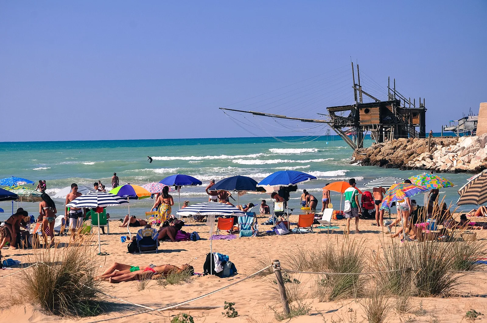
The beach of Punta Penna lies in Abruzzo, in the municipality of Vasto, on the northern part of the headland of the same name. The headland is in the southern part of the Costa dei Trabocchi and of the province of Chieti. Its southern part is home to the port of Vasto. The beach is a long tongue of sand shaped like an amphitheatre, bounded at the back by dunes. The shore is mostly sandy, except for the northern stretch known as the spiaggia dei Libertini, where the shore is made of pebbles. Behind it there is a system of cliffs, beyond which lies the industrial area of the port of Vasto.
After the First World War the port of Vasto was downgraded to a fourth-class port and, with local funding, only the western pier, the quay and the yard behind it were built. The construction of that pier caused the beach of Punta Penna to form, with a dune system connected to that of Punta Aderci.
Several traces remain of the ancient history of Punta Penna. The natural harbour of Punta Penna hosted an Italic settlement with a port serving ancient Histonium. In the Middle Ages a fortress and a small settlement called Pennaluce were built there. In the same period the fifteenth-century church of Santa Maria di Pennaluce, rebuilt in 1887 in Romanesque style, and the tower of Punta Penna from 1557, part of the defensive system of coastal towers of the Kingdom of Naples, were erected. In 1907 a military port was established at Punta Penna and in the same year work began on the lighthouse, completed in 1912. During the Second World War the port was heavily damaged and the lighthouse was knocked down by the retreating German army.
Getting there
The beach is reached along a stepped path. To get there you follow the SS16 state road to the Punta Penna area, where the port of Vasto is located. The centre of Vasto is 5.7 km south of the beach as the crow flies. Casalbordino is 9.7 km to the west as the crow flies and San Salvo 14.8 km to the south. In the early 2000s the Adriatic railway, which once ran along the sea, was moved to a route further inland, largely in tunnels.
When to go
According to QualeSpiaggia data, the beach faces north. With the north wind (tramontana), the north-east wind (grecale) and the north-west wind (maestrale), the wind blows in from the sea and the beach is exposed to waves. With the south-east wind (scirocco), the south wind (ostro) and the south-west wind (libeccio), the wind blows from the land and the beach is sheltered, with calmer water close to shore. The east wind (levante) and the west wind (ponente) hit it from the side. This is an indication based on the orientation of the coast, not a forecast. On days with onshore wind it is worth checking the conditions before going into the water.
Wikipedia describes the beach as the main tourist attraction of the headland, known for its wild setting. Tourism is an important part of Vasto's economy, particularly in summer.
Seabed and sea
The seabed is sandy and slopes gently. With a bit of luck you can swim alongside sea turtles or see a dolphin in the distance. In the 2025 season the European Environment Agency rated the bathing water quality as excellent. At the spiaggia dei Libertini, 0.8 km away as the crow flies, the fine sand gives way to pebbles, but the seabed remains sandy, shallow and dotted with small rocks.
Facilities and free beach
The beach is free and open to everyone at no charge. Close to the beach there is an information point of the reserve, renting out canoes and mountain bikes. In 2026 Punta Penna appears on the FEE Blue Flag list for the municipality of Vasto, together with Vignola/San Nicola and San Tommaso.
On the northern pier of the port, facing the beach, stand the trabocchi Trimalcione, Molo di Vasto and Puntamare. The trabocchi are a kind of fishing platform on stilts, typical of the stretch of central Adriatic coast between Ortona and Vasto. Some have a restaurant and serve fish dinners suspended over the water.
Rules and protected areas
The beach lies entirely within the Punta Aderci guided nature reserve. According to Italia.it the reserve is the first protected area established along the coast of Abruzzo and covers 285 hectares from the port of Vasto to the mouth of the Sinello river. Including the outer area, the total reaches 400 hectares. Visitors are asked to respect the plants and every corner of the area.
The dune system of the beach is a habitat for species such as the Kentish plover (fratino), the yellow-legged gull, the purple heron, the sparrowhawk, the marsh harrier and the skylark. The Kentish plover is the symbol of the reserve, because on the Vasto coast it nests on the beaches, laying its eggs on the ground. It should not be disturbed while it feeds. The plants include sea daffodils, spurge, yellow horned poppy, curry plant and myrtle. The dunes of the reserve can reach 10 metres in height.
With children
According to Italia.it the shape of the beach suits everyone, including families with children. The portal describes the seabed as ideal for pleasant and safe bathing. For a full day it is worth bringing water and some shade.
Nearby
Walking along the shore you reach the spiaggia dei Libertini, 0.8 km to the north-west as the crow flies. According to a legend, the name comes from the nuns of a local convent, who a century ago came here to sunbathe, uncovering their legs and arms a little. From the spiaggia dei Libertini a flight of steps climbs to the top of the cliff and to the headland of Punta Aderci, 26 metres above sea level. Beyond the headland there is another small beach and then the beach of Mottagrossa, made of pebbles, 1.9 km north-west of Punta Penna as the crow flies.
From Mottagrossa to the mouth of the Sinello river, the boundary of the reserve, runs a 3 km scenic route. It can be covered on foot or by mountain bike, through pine woods, valleys and stretches of Mediterranean scrub. It is worth getting the trail map provided by the reserve administration. Towards the mouth of the Sinello you come across the brick arches that once marked the railway line, and from there the path along the river begins. The Via verde dei Trabocchi cycle path was created on the old railway line and is part of the Adriatic cycle route.
Italia.it also suggests visiting the lighthouse, 70 metres tall: according to the portal it is the second tallest in Italy, after the Lanterna di Genova. You reach the top by climbing 307 steps and, on clear days, the view stretches from Ortona to the Gargano. Vasto is the last town in Abruzzo on the Adriatic coast of the Costa dei Trabocchi, on the border with Molise.