
 43.342° N, 10.455° E


Complete guide
Spiaggia di Vada: beach guide
What the beach is like
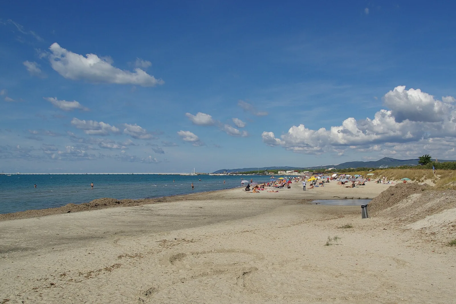
The beach of Vada lies in the municipality of Rosignano Marittimo, in the province of Livorno, Tuscany, and faces the Ligurian Sea. Vada is a hamlet of the municipality and belongs to the Val di Cecina. The beach's reference point lies 1 km as the crow flies south of the village of Vada. The beach floor is sand. The beaches of Vada are wide, with light, fine sand, and stretch for more than 5 km.
The shore is shaded by thick pine woods. The pine wood running parallel to the coast was planted in the nineteenth century, at the time of the Lorraine land reclamation, to protect the fields from the strong, salty sea winds. In Etruscan and Roman times this stretch of coast was known as Vada Volaterrana, from the Latin vada, meaning shallow waters and fords, and from its belonging to the territory of Volterra. The coast was Volterra's outlet to the sea, and the port was protected by the shoals of Vada. Wikipedia links Vada's reputation as a resort to the bathing quality of its water, certified several times with the Blue Flag (Bandiera Blu).
Getting there
The centre of the municipal seat, Rosignano Marittimo, lies 7.3 km as the crow flies north of the beach, while Cecina is 6.1 km to the south-east. Livorno, the provincial capital, is 26 km as the crow flies to the north-west. The SP 39 Vecchia Aurelia runs through the village's main square, where a milestone marks kilometre 287 from the Capitol in Rome. For a day at the beach it is worth bringing water and sun protection.
When to go
Visit Tuscany calls Vada a resort visited by tourists from all over the world. The Secche di Vada, a stretch of sea with shallow seabeds, attract anglers in every season. According to Visit Tuscany, at the end of June Vada sull'Aia is held, a popular festival of rural origin with wheat threshing done with vintage threshers and tractors.
The beach faces west. With the libeccio, the ponente and the maestrale the wind blows from the sea and the beach is exposed to waves and rough sea. With the grecale, the levante and the scirocco the wind blows from land and the beach is sheltered, with calmer water close to shore. The tramontana and the ostro blow across the shoreline instead. These are indications derived from the orientation of the coast, not weather forecasts.
Seabed and sea
For the 2025 season the European Environment Agency (EEA) rates the bathing water quality of this stretch as excellent. Offshore, on rocks rising from the shallow seabed of the shoals, stands the Vada lighthouse, which warns boats of the dangers of this stretch. The lighthouse is a few miles off the coast and, according to the Italia.it portal, still sends its signals to boats today. Amphorae and terracotta vases lie on the seabed, which Visit Tuscany presents as evidence of the passage of Saracen pirates.
Along the coast there are several Second World War bunkers, some of which now stand in the sea, about ten metres from the shore. They were not built in the water: it was coastal erosion that separated them from the mainland. The sources consulted do not give the water depth off the beach. It is advisable to enter the water slowly and look at the seabed before swimming further out.
Facilities and free beach
Visit Tuscany describes a shore where beach clubs alternate with wide stretches of free beach, where umbrellas and deckchairs can be rented. The site also describes Vada as an important boating centre, with a small harbour equipped for mooring boats, and recommends it for water sports such as windsurfing, pointing to a rich and varied range of accommodation and seafood cooking rooted in tradition.
Nearby
The beach of Punta del Tesorino lies 1.4 km as the crow flies to the south, and further on in the same direction is the beach of Mazzanta. In 2026, in the municipality of Rosignano Marittimo, the FEE's Blue Flag beach list includes Castiglioncello and La Mazzanta. At La Mazzanta, in the locality of Molino a Fuoco, the Ferro di Cavallo can still be visited: a system of drainage channels regulated with sluice gates by workers of the Grand Duchy of Tuscany. Visit Tuscany names the rada del Saraceno, the Pietra Bianca pine wood, the Molino a Fuoco and the Mazzanta among the best-known spots of the area.
To the north, in the locality of Pietra Bianca, between the village of Vada and Rosignano Solvay, are the Spiagge Bianche. The Spiagge Bianche are 3.8 km as the crow flies from the reference point of the beach of Vada. The white colour of the sand of the Spiagge Bianche is due to discharges from the local Solvay plant, which processed limestone materials for years. The river Fine also flows into the sea at the Spiagge Bianche, after a course of 22 km.
In the village, behind the harbour, stands the tower of Vada, which housed the lighthouse between 1867 and 1979. In the locality of San Gaetano, on the northern outskirts of the village, the University of Pisa has been excavating a Roman commercial quarter from the first century AD since 1982, with warehouses and two bath complexes. Finds from the excavations are on display at the Museo civico archeologico of Rosignano Marittimo.
Sources
- Wikipedia (it) — Vada (Rosignano Marittimo)
- QualeSpiaggia — open data spiagge (CC BY 4.0)
- OpenStreetMap
- Le spiagge bianche di Vada | Visit Tuscany
- Vada | Visit Tuscany
- EEA — Bathing water quality 2025 (IT009049017015)
- Vada, borgo in Toscana: cosa vedere - Italia.it
- FEE Italia — Bandiera Blu 2026, elenco spiagge